Area Overview for HU12 9WT
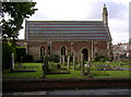
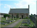
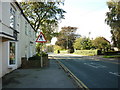
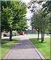
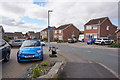
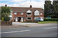
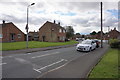
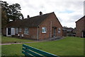
Photos of HU12 9WT
Area Information
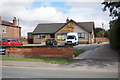
Living in HU12 9WT means being part of a small, tightly knit residential cluster in England. With a population of 1,641 and a density of 136 people per square kilometre, the area feels intimate, offering a balance between community and space. The postcode covers a compact cluster of homes, many of which are owner-occupied, suggesting a stable, long-term presence of residents. Proximity to the Hull Ferry Terminal adds practical connectivity, linking the area to nearby towns and beyond. Daily life here is likely shaped by local shops and amenities, with a low crime risk score of 92/100 reinforcing a sense of safety. The absence of environmental constraints like protected woodlands or AONB designations means development is unlikely to disrupt the area’s character. For those seeking a quiet, secure place to live with easy access to transport, HU12 9WT offers a straightforward, no-frills lifestyle. Its small size means neighbours are likely to be familiar faces, and the lack of major infrastructure nearby ensures a low-key, residential atmosphere.
- Area Type
- Postcode
- Area Size
- Not available
- Population
- 1641
- Population Density
- 136 people/km²
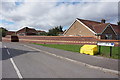
The property market in HU12 9WT is dominated by owner-occupied homes, with 88% of residents living in properties they own. This contrasts with areas where rental markets dominate, suggesting a community of long-term residents rather than transient tenants. The accommodation type is primarily houses, which is unusual in many modern developments where flats are more common. This indicates a traditional, family-friendly housing stock, likely with larger gardens and more space. For buyers, this means the area is less likely to have high turnover or speculative investment, offering a more stable market. However, the small size of the postcode area means the housing stock is limited, and buyers should consider nearby regions for more options. The high home ownership rate also implies that properties may be held for the long term, potentially affecting availability for new buyers.
House Prices in HU12 9WT
No properties found in this postcode.
Energy Efficiency in HU12 9WT
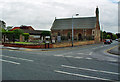
Residents of HU12 9WT have access to a range of local amenities within practical reach. The area includes five retail outlets, such as Co-op Petrol, Heron Hedon, and Sainsburys Hedon, providing everyday shopping and fueling needs. The Hull Ferry Terminal is a key transport hub, offering connections to nearby destinations and enhancing the area’s accessibility. While there are no named parks or leisure facilities in the data, the absence of environmental constraints like protected woodlands or AONB designations suggests open spaces may be available nearby. The combination of local shops and ferry access creates a convenient, self-contained lifestyle, reducing the need for long commutes. The modest scale of the area means amenities are likely to be within walking distance, fostering a community-oriented way of life.
Amenities
Schools
| Rank | School | Type | Entry gender | Ages |
|---|
Explore more schools in this area
Go to Schools tabDemographics
The community in HU12 9WT is predominantly composed of adults aged 30–64, with a median age of 47. This suggests a mature, settled population, likely with established careers and families. Home ownership is exceptionally high at 88%, indicating a strong preference for long-term residency over renting. The area is characterised by houses rather than flats, reflecting a traditional, family-oriented housing stock. The predominant ethnic group is White, though no specific diversity statistics are provided. The low population density of 136 people per square kilometre implies a spread-out, suburban feel rather than a densely populated urban environment. With no data on deprivation levels, it’s unclear how economic factors might influence quality of life, but the high home ownership rate and low crime risk suggest a relatively stable socioeconomic profile.
Household Size
Accommodation Type
Tenure
Ethnic Group
Religion
Household Composition
Age
Household Deprivation
NS-SEC
Explore more demographic insights in this area
Go to Demographics tabPlanning
Planning Constraints
- Flood RiskPremium
- Ramsar Wetland SitesPremium
- Area of Outstanding Natural BeautyPremium
- Protected Nature ReservePremium
- Protected WoodlandPremium