Area Overview for HU12 9TG
Photos of HU12 9TG
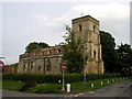
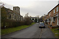
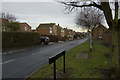
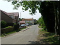
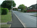
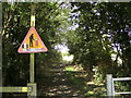
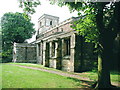
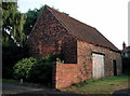
72 photos from this area
Area Information
Key information about the HU12 9TG including its size, population, and administrative classification.
- Area Type
- Postcode
- Area Size
- 3919 m²
- Population
- 1713
- Population Density
- 688 people/km²
House Prices in HU12 9TG
12
Properties
£106,722
Average Sold Price
£39,000
Lowest Price
£175,000
Highest Price
Showing 12 properties
| Address | Type | Beds | Baths | Last Sale Price | Last Sale Date | |
|---|---|---|---|---|---|---|
| 6 Langdale Drive, Keyingham, HU12 9TG | Semi-detached | 4 | 2 | £175,000 | Apr 2025 | |
| 9 Langdale Drive, Keyingham, HU12 9TG | house | - | - | £170,000 | Apr 2022 | |
| 2 Langdale Drive, Keyingham, HU12 9TG | Semi-detached | - | - | £128,000 | Feb 2008 | |
| 1 Langdale Drive, Keyingham, HU12 9TG | Detached | 3 | 1 | £135,000 | Feb 2007 | |
| 4 Langdale Drive, Keyingham, HU12 9TG | house | - | - | £120,000 | Feb 2007 | |
| 12 Langdale Drive, Keyingham, HU12 9TG | Semi-detached | - | - | £85,000 | Nov 2003 | |
| 11 Langdale Drive, Keyingham, HU12 9TG | Semi-detached | - | - | £39,000 | Oct 2001 | |
| 3 Langdale Drive, Keyingham, HU12 9TG | Semi-detached | - | - | £56,000 | Oct 2001 | |
| 10 Langdale Drive, Keyingham, HU12 9TG | Bungalow | - | - | £52,500 | Mar 2001 | |
| 7 Langdale Drive, Keyingham, HU12 9TG | Retail | 2 | 1 | - | - |
Page 1 of 2
Energy Efficiency in HU12 9TG
Amenities
Schools
| Rank | School | Type | Entry gender | Ages |
|---|
Explore more schools in this area
Go to Schools tabDemographics
Household Size
Two person
most common
Accommodation Type
Houses
most common
Tenure
78
majority
Ethnic Group
White
most common
Religion
N/A
most common
Household Composition
N/A
most common
Age
47
median
Adults (30-64 years)
most common
Household Deprivation
N/A
with no deprivation
NS-SEC
28
in Lower managerial occupations
Explore more demographic insights in this area
Go to Demographics tabPlanning
Planning Constraints
- Flood RiskPremium
- Ramsar Wetland SitesPremium
- Area of Outstanding Natural BeautyPremium
- Protected Nature ReservePremium
- Protected WoodlandPremium