Area Overview for HU12 8SX
Photos of HU12 8SX
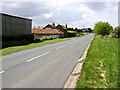
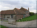
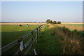

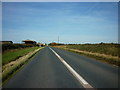
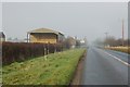
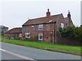
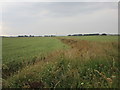

13 photos from this area
Area Information
Key information about the HU12 8SX including its size, population, and administrative classification.
- Area Type
- Postcode
- Area Size
- 2.3 km²
- Population
- 1391
- Population Density
- 239 people/km²
House Prices in HU12 8SX
12
Properties
£217,000
Average Sold Price
£217,000
Lowest Price
£217,000
Highest Price
Showing 12 properties
| Address | Type | Beds | Baths | Last Sale Price | Last Sale Date | |
|---|---|---|---|---|---|---|
| Honey Nook Farm, Weghill Road, Preston, HU12 8SX | Detached | - | - | £217,000 | May 2021 | |
| Little Weghill Farm, Weghill Road, Preston, HU12 8SX | house | - | - | - | - | |
| Weghill Farm, Weghill Road, Preston, HU12 8SX | house | - | - | - | - | |
| Rands Farm, Weghill Road, Preston, HU12 8SX | house | - | - | - | - | |
| Nuthill Farm, Weghill Road, Preston, HU12 8SX | house | - | - | - | - | |
| Owl Cottage, Weghill Road, Preston, HU12 8SX | hotel | - | - | - | - | |
| Tennis 742M From Hall Field Farm, Preston Road 34M From Unnamed Road, Burstwick Bridleway Number 8, Burstwick, HU12 8SX | Leisure | - | - | - | - | |
| Unit 4, Preston Nurseries, Weghill Road, Preston, HU12 8SX | Industrial | - | - | - | - | |
| Harvest Barn, Weghill Road, Preston, HU12 8SX | Detached | - | - | - | - | |
| Land South Of Preston Carp Lakes, Weghill Road, Preston, HU12 8SX | Leisure | - | - | - | - |
Page 1 of 2
Energy Efficiency in HU12 8SX
Amenities
Schools
| Rank | School | Type | Entry gender | Ages |
|---|
Explore more schools in this area
Go to Schools tabDemographics
Household Size
Two person
most common
Accommodation Type
Houses
most common
Tenure
80
majority
Ethnic Group
White
most common
Religion
N/A
most common
Household Composition
N/A
most common
Age
47
median
Adults (30-64 years)
most common
Household Deprivation
N/A
with no deprivation
NS-SEC
28
in Lower managerial occupations
Explore more demographic insights in this area
Go to Demographics tabPlanning
Planning Constraints
- Flood RiskPremium
- Ramsar Wetland SitesPremium
- Area of Outstanding Natural BeautyPremium
- Protected Nature ReservePremium
- Protected WoodlandPremium