Area Overview for HU12 0TS
Photos of HU12 0TS


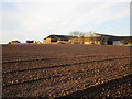
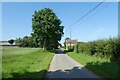
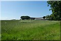
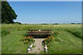

33 photos from this area
Area Information
Key information about the HU12 0TS including its size, population, and administrative classification.
- Area Type
- Postcode
- Area Size
- 10.7 hectares
- Population
- 1347
- Population Density
- 31 people/km²
House Prices in HU12 0TS
26
Properties
£133,176
Average Sold Price
£38,000
Lowest Price
£240,000
Highest Price
Showing 26 properties
| Address | Type | Beds | Baths | Last Sale Price | Last Sale Date | |
|---|---|---|---|---|---|---|
| Dromuna, High Street, Easington, HU12 0TS | Detached | 3 | 2 | £217,500 | Jun 2023 | |
| Cobble Cottage, 2 High Street, Easington, HU12 0TS | Terraced | 4 | 2 | £210,000 | Nov 2022 | |
| 2, Newholme Cottages, High Street, Easington, HU12 0TS | Semi-detached | 1 | 1 | £130,000 | Sep 2022 | |
| Pax Cottage, High Street, Easington, HU12 0TS | Semi-detached | - | - | £240,000 | Jul 2022 | |
| High Garth, High Street, Easington, HU12 0TS | Bungalow | 2 | 1 | £130,000 | Sep 2020 | |
| 2, Maister Cottages, High Street, Easington, HU12 0TS | Semi-detached | 3 | 1 | £110,000 | Sep 2019 | |
| 16 High Street, Easington, HU12 0TS | Detached | 3 | - | £105,000 | May 2019 | |
| 4 High Street, Easington, HU12 0TS | house | - | - | £52,000 | May 2015 | |
| Ryton, High Street, Easington, HU12 0TS | Detached | - | - | £167,000 | Nov 2014 | |
| Gable Ends, High Street, Easington, HU12 0TS | Cottage | 4 | - | £165,500 | May 2014 |
Page 1 of 3
Energy Efficiency in HU12 0TS
Amenities
Schools
| Rank | School | Type | Entry gender | Ages |
|---|
Explore more schools in this area
Go to Schools tabDemographics
Household Size
Two person
most common
Accommodation Type
Houses
most common
Tenure
78
majority
Ethnic Group
White
most common
Religion
N/A
most common
Household Composition
N/A
most common
Age
47
median
Adults (30-64 years)
most common
Household Deprivation
N/A
with no deprivation
NS-SEC
27
in Lower managerial occupations
Explore more demographic insights in this area
Go to Demographics tabPlanning
Planning Constraints
- Flood RiskPremium
- Ramsar Wetland SitesPremium
- Area of Outstanding Natural BeautyPremium
- Protected Nature ReservePremium
- Protected WoodlandPremium