Area Overview for HU11 4DR
Photos of HU11 4DR
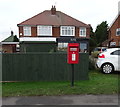
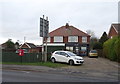
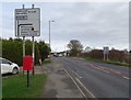
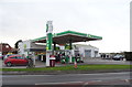
19 photos from this area
Area Information
Key information about the HU11 4DR including its size, population, and administrative classification.
- Area Type
- Postcode
- Area Size
- 1.2 hectares
- Population
- 1409
- Population Density
- 162 people/km²
House Prices in HU11 4DR
24
Properties
£131,925
Average Sold Price
£56,500
Lowest Price
£192,500
Highest Price
Showing 24 properties
| Address | Type | Beds | Baths | Last Sale Price | Last Sale Date | |
|---|---|---|---|---|---|---|
| 16 Albemarle Road, Bilton, HU11 4DR | Semi-detached | 3 | 1 | £192,500 | Jun 2025 | |
| 8 Albemarle Road, Bilton, HU11 4DR | Bungalow | - | - | £175,000 | Jan 2022 | |
| 13 Albemarle Road, Bilton, HU11 4DR | house | - | - | £150,000 | Mar 2020 | |
| 12 Albemarle Road, Bilton, HU11 4DR | Semi-detached | 4 | 1 | £160,000 | Apr 2017 | |
| 19 Albemarle Road, Bilton, HU11 4DR | Semi-detached | 3 | - | £142,000 | Mar 2015 | |
| 15 Albemarle Road, Bilton, HU11 4DR | Semi-detached | - | - | £122,000 | Aug 2009 | |
| 18 Albemarle Road, Bilton, HU11 4DR | Semi-detached | - | - | £150,000 | Jul 2008 | |
| 7 Albemarle Road, Bilton, HU11 4DR | Semi-detached | - | - | £117,000 | Aug 2007 | |
| Trecarn, 4 Albemarle Road, Bilton, HU11 4DR | Detached | 4 | 3 | £133,150 | Aug 2006 | |
| 1A Albemarle Road, Bilton, HU11 4DR | Detached | - | - | £125,000 | Nov 2003 |
Page 1 of 3
Energy Efficiency in HU11 4DR
Amenities
Schools
| Rank | School | Type | Entry gender | Ages |
|---|
Explore more schools in this area
Go to Schools tabDemographics
Household Size
Two person
most common
Accommodation Type
Houses
most common
Tenure
86
majority
Ethnic Group
White
most common
Religion
N/A
most common
Household Composition
N/A
most common
Age
47
median
Adults (30-64 years)
most common
Household Deprivation
N/A
with no deprivation
NS-SEC
30
in Lower managerial occupations
Explore more demographic insights in this area
Go to Demographics tabPlanning
Planning Constraints
- Flood RiskPremium
- Ramsar Wetland SitesPremium
- Area of Outstanding Natural BeautyPremium
- Protected Nature ReservePremium
- Protected WoodlandPremium