Area Overview for HU10 7XN
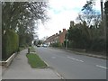
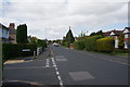
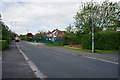
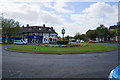
Photos of HU10 7XN


Area Information
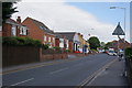
Living in HU10 7XN means inhabiting a small, tightly knit residential cluster in England, home to 1,513 residents. This area is defined by its compact size and the presence of family-oriented housing, with a median age of 47 suggesting a stable, mature community. Daily life here is shaped by proximity to local amenities, including retail outlets like Sainsburys Willerby and Aldi Kirk, and easy access to rail services at Cottingham and Hessle stations. The area’s character is rooted in its practicality: homes are predominantly owner-occupied, with 79% of residents living in their own properties, and the housing stock is largely composed of houses rather than flats. While the postcode lacks natural or environmental constraints, its appeal lies in low risk factors—flood risk is negligible, and crime rates are below average. For those seeking a quiet, safe place with access to essential services, HU10 7XN offers a straightforward, no-frills lifestyle.
- Area Type
- Postcode
- Area Size
- Not available
- Population
- 1513
- Population Density
- 3166 people/km²
The property market in HU10 7XN is characterised by a high rate of home ownership—79% of residents live in properties they own—suggesting a stable, owner-occupied market. The housing stock is predominantly composed of houses rather than flats, which aligns with the area’s small, residential nature. This makes it an attractive option for buyers seeking family homes or long-term investments. The compact size of the postcode means the market is limited in scale, but the focus on owner-occupied properties implies strong local demand. For buyers, this suggests a low turnover of properties and potentially higher retention rates. The absence of rental properties in the data indicates that the area is not a hotbed for short-term lets or speculative investment, instead catering to those prioritising stability and permanence.
House Prices in HU10 7XN
No properties found in this postcode.
Energy Efficiency in HU10 7XN
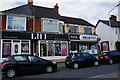
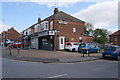
The lifestyle in HU10 7XN is shaped by its proximity to essential amenities. Local retail options include Sainsburys Willerby, Aldi Kirk, and Tesco Willerby Kirk, providing access to groceries and daily necessities without the need for long commutes. The area’s rail links to Cottingham, Hessle, and North Ferriby stations offer connections to nearby employment hubs and leisure opportunities. While the data does not mention parks or leisure facilities, the absence of environmental constraints like AONB or protected woodlands suggests room for local recreational spaces. The compact nature of the postcode means amenities are tightly clustered, contributing to a convenient, self-contained lifestyle. Residents can enjoy a balance of practicality and accessibility, with services and transport options tailored to everyday needs.
Amenities
Schools
Residents of HU10 7XN have access to a range of local schools, including Willerby Carr Lane Junior School and Willerby Carr Lane Infant School, both primary institutions serving younger children. Wolfreton School and Sixth Form College is listed twice in the data, once as a primary and once as an academy, though this may reflect a transition in its designation. The presence of both primary and academy schools suggests a comprehensive educational offering, though specific Ofsted ratings are not provided. Families may benefit from the proximity of these schools, which are likely to be within walking distance for many residents. The mix of school types could indicate a focus on both foundational education and broader academic pathways, though further details on curriculum or performance are not available in the data.
| Rank | School | Type | Entry gender | Ages |
|---|
Explore more schools in this area
Go to Schools tabDemographics
The community in HU10 7XN is predominantly composed of adults aged 30–64, reflecting a mature demographic with a median age of 47. Home ownership is high, with 79% of residents living in properties they own, indicating a stable, long-term population. The area is largely residential, with houses being the primary accommodation type. Ethnic diversity is limited, as the predominant group is White. This demographic profile suggests a community focused on family living and long-term settlement. The absence of significant deprivation data means quality of life here is likely tied to the availability of local services and low risk factors. For instance, the area’s below-average crime rate (71/100 safety score) reinforces a sense of security, while the lack of environmental constraints allows for straightforward development and living.
Household Size
Accommodation Type
Tenure
Ethnic Group
Religion
Household Composition
Age
Household Deprivation
NS-SEC
Explore more demographic insights in this area
Go to Demographics tabPlanning
Planning Constraints
- Flood RiskPremium
- Ramsar Wetland SitesPremium
- Area of Outstanding Natural BeautyPremium
- Protected Nature ReservePremium
- Protected WoodlandPremium