Area Overview for HU10 7TJ
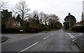
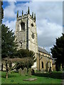
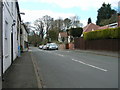
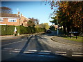
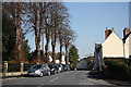
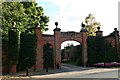
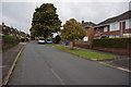
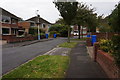
Photos of HU10 7TJ
Area Information
Living in HU10 7TJ means being part of a compact, tightly knit residential cluster in England’s East Riding of Yorkshire. The area covers just 2.9 hectares, yet it supports a population of 1,859 people, translating to a high density of 1,745 residents per square kilometre. This small footprint creates a sense of intimacy, where daily life is shaped by proximity to local amenities and a quiet, stable environment. The area’s character is defined by its mature population, with a median age of 47 and most residents falling into the 30–64 age range. This suggests a community rooted in long-term residency, with strong local ties. The absence of major planning constraints, such as protected woodlands or AONB designations, means development is unencumbered, though the area remains largely residential. For buyers, HU10 7TJ offers a blend of practicality and peace, with no significant environmental risks and a crime risk score of 78, indicating a safer neighbourhood. Its compact size and accessibility to nearby rail networks make it a practical choice for those seeking a balanced lifestyle.
- Area Type
- Postcode
- Area Size
- 2.9 hectares
- Population
- 1859
- Population Density
- 1745 people/km²
The property market in HU10 7TJ is overwhelmingly owner-occupied, with 89% of homes owned by residents rather than rented. This high rate of home ownership suggests a community of long-term residents who value stability and investment in property. The accommodation type is exclusively houses, which is unusual for areas with high population density. This indicates that the housing stock is likely older, with larger properties suited to families. Given the compact size of the area, the availability of houses may be limited, making the market competitive for buyers. The lack of planning constraints, such as protected sites or flood risks, means new developments are unlikely to disrupt the existing residential character. For buyers, this small area offers a chance to own a home in a stable, low-risk environment, though the limited size may mean proximity to nearby towns or cities is necessary for additional amenities.
House Prices in HU10 7TJ
Showing 3 properties
| Address | Type | Beds | Baths | Last Sale Price | Last Sale Date | |
|---|---|---|---|---|---|---|
| Hairdressing Salon, Golf Club House, 27 Packman Lane, Kirk Ella, HU10 7TJ | Office | - | - | - | - | |
| First 4 Instuctors Limited, Office 1, Golf Club House, 27 Packman Lane, Kirk Ella, HU10 7TJ | retail_financial | - | - | - | - | |
| Office 3, Golf Club House, 27 Packman Lane, Kirk Ella, HU10 7TJ | Office | - | - | - | - |
Energy Efficiency in HU10 7TJ
Residents of HU10 7TJ have access to a range of nearby amenities that support daily life. The retail sector includes Sainsburys Willerby, Lidl Kirk, and Aldi Kirk, offering convenience for grocery shopping. For transport, five rail stations—Hessle, Cottingham, and North Ferriby—provide regular services to regional centres, while Brough Airport offers additional connectivity. The area’s small size means these amenities are within practical reach, reducing the need for long commutes. The absence of major planning constraints and low environmental risks ensures that these facilities remain accessible without disruption. The presence of multiple retail options and transport links suggests a community that prioritises practicality and ease of access. While the area itself is compact, its proximity to larger towns likely means residents can enjoy a broader range of leisure and cultural opportunities beyond the immediate vicinity.
Amenities
Schools
| Rank | School | Type | Entry gender | Ages |
|---|
Explore more schools in this area
Go to Schools tabDemographics
The community in HU10 7TJ is predominantly composed of adults aged 30–64, with a median age of 47. This suggests a population largely settled in careers and family life, rather than younger or retired residents. Home ownership is exceptionally high at 89%, reflecting a strong preference for owning property over renting. The area’s accommodation is almost entirely houses, which aligns with the demographic profile of established families. The predominant ethnic group is White, with no data provided on other groups. The high home ownership rate and age distribution indicate a stable, low-turnover community. While no specific deprivation data is mentioned, the absence of planning constraints and low crime risk suggests a quality of life that supports long-term residency. The population density of 1,745 people per square kilometre is notably high for a small area, which may influence the character of local interactions and the availability of shared spaces.
Household Size
Accommodation Type
Tenure
Ethnic Group
Religion
Household Composition
Age
Household Deprivation
NS-SEC
Explore more demographic insights in this area
Go to Demographics tabPlanning
Planning Constraints
- Flood RiskPremium
- Ramsar Wetland SitesPremium
- Area of Outstanding Natural BeautyPremium
- Protected Nature ReservePremium
- Protected WoodlandPremium