Area Overview for HU10 7SD
Photos of HU10 7SD
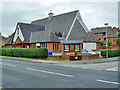
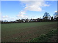
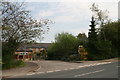
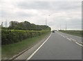
27 photos from this area
Area Information
Key information about the HU10 7SD including its size, population, and administrative classification.
- Area Type
- Postcode
- Area Size
- 57.3 hectares
- Population
- 1483
- Population Density
- 459 people/km²
House Prices in HU10 7SD
37
Properties
£482,250
Average Sold Price
£59,000
Lowest Price
£900,000
Highest Price
Showing 37 properties
| Address | Type | Beds | Baths | Last Sale Price | Last Sale Date | |
|---|---|---|---|---|---|---|
| Manor Lodge, West Ella Road, Kirk Ella, HU10 7SD | Unknown | - | - | £550,000 | Mar 2025 | |
| 229 West Ella Road, West Ella, HU10 7SD | Detached | 3 | 2 | £625,000 | Jun 2023 | |
| Calderstones, West Ella Road, Swanland, HU10 7SD | house | - | - | £700,000 | Jan 2022 | |
| Elsham, West Ella Road, Swanland, HU10 7SD | house | - | - | £700,000 | Jun 2021 | |
| Orchard Lea, West Ella Road, Swanland, HU10 7SD | house | 12 | 4 | £900,000 | Oct 2020 | |
| 249 West Ella Road, West Ella, HU10 7SD | Detached | 3 | - | £562,500 | Jan 2014 | |
| Moss Brow Cottage, West Ella Road, Kirk Ella, HU10 7SD | house | 5 | - | £740,000 | Jul 2012 | |
| 211 West Ella Road, West Ella, HU10 7SD | house | - | - | £570,000 | Mar 2010 | |
| 243 West Ella Road, West Ella, HU10 7SD | Detached | - | - | £710,000 | Jun 2006 | |
| Easenby Croft, West Ella Road, Swanland, HU10 7SD | Land | 4 | 3 | £635,000 | Apr 2006 |
Page 1 of 4
Energy Efficiency in HU10 7SD
Amenities
Schools
| Rank | School | Type | Entry gender | Ages |
|---|
Explore more schools in this area
Go to Schools tabDemographics
Household Size
Two person
most common
Accommodation Type
Houses
most common
Tenure
95
majority
Ethnic Group
White
most common
Religion
N/A
most common
Household Composition
N/A
most common
Age
47
median
Adults (30-64 years)
most common
Household Deprivation
N/A
with no deprivation
NS-SEC
47
in Lower managerial occupations
Explore more demographic insights in this area
Go to Demographics tabPlanning
Planning Constraints
- Flood RiskPremium
- Ramsar Wetland SitesPremium
- Area of Outstanding Natural BeautyPremium
- Protected Nature ReservePremium
- Protected WoodlandPremium