Area Overview for HU10 7ES
Photos of HU10 7ES
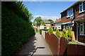
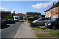
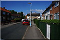
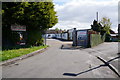
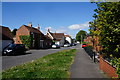
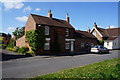
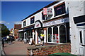
83 photos from this area
Area Information
Key information about the HU10 7ES including its size, population, and administrative classification.
- Area Type
- Postcode
- Area Size
- 1.7 hectares
- Population
- 2172
- Population Density
- 3005 people/km²
House Prices in HU10 7ES
68
Properties
£195,018
Average Sold Price
£63,144
Lowest Price
£485,758
Highest Price
Showing 68 properties
| Address | Type | Beds | Baths | Last Sale Price | Last Sale Date | |
|---|---|---|---|---|---|---|
| 95 Petfield Drive, Anlaby, HU10 7ES | Semi-detached | 3 | 1 | £190,000 | Dec 2024 | |
| 27 Petfield Drive, Anlaby, HU10 7ES | Detached | 4 | 2 | £307,000 | Apr 2024 | |
| 89 Petfield Drive, Anlaby, HU10 7ES | house | - | - | £170,000 | Feb 2024 | |
| 51 Petfield Drive, Anlaby, HU10 7ES | Semi-detached | 3 | 2 | £221,500 | Oct 2023 | |
| 35 Petfield Drive, Anlaby, HU10 7ES | Semi-detached | - | - | £195,000 | Aug 2023 | |
| 15 Petfield Drive, Anlaby, HU10 7ES | Detached | 3 | 1 | £286,000 | Jul 2023 | |
| 21 Petfield Drive, Anlaby, HU10 7ES | Semi-detached | 3 | 1 | £225,000 | Jun 2023 | |
| 29 Petfield Drive, Anlaby, HU10 7ES | Detached | 3 | 2 | £250,000 | May 2023 | |
| 31 Petfield Drive, Anlaby, HU10 7ES | Semi-detached | 3 | 1 | £218,000 | Jan 2023 | |
| 59 Petfield Drive, Anlaby, HU10 7ES | Retail | 3 | 2 | £287,000 | Oct 2022 |
Page 1 of 7
Energy Efficiency in HU10 7ES
Amenities
Schools
| Rank | School | Type | Entry gender | Ages |
|---|
Explore more schools in this area
Go to Schools tabDemographics
Household Size
One person
most common
Accommodation Type
Houses
most common
Tenure
58
majority
Ethnic Group
White
most common
Religion
N/A
most common
Household Composition
N/A
most common
Age
47
median
Adults (30-64 years)
most common
Household Deprivation
N/A
with no deprivation
NS-SEC
32
in Lower managerial occupations
Explore more demographic insights in this area
Go to Demographics tabPlanning
Planning Constraints
- Flood RiskPremium
- Ramsar Wetland SitesPremium
- Area of Outstanding Natural BeautyPremium
- Protected Nature ReservePremium
- Protected WoodlandPremium