Area Overview for HU10 7EE
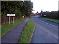
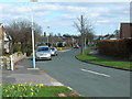
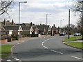
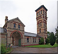
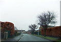
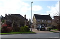
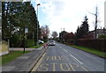
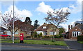
Photos of HU10 7EE


Area Information
Living in HU10 7EE means being part of a tightly knit residential cluster in England, where 1,620 people reside across a compact area. With a population density of 729 people per square kilometre, this small postcode area offers a sense of community, though its size means it is more suited to those seeking a quiet, established neighbourhood. The area is characterised by a mature demographic, with a median age of 47 and a majority of residents aged between 30 and 64. This suggests a stable, long-term population, with 92% owning their homes. The housing stock is predominantly houses, reflecting a traditional, low-density residential pattern. Proximity to independent schools like Tranby and Hull Preparatory School adds to the appeal for families, while nearby amenities such as Morrisons and Sainsburys ensure everyday needs are met. Despite its small size, HU10 7EE is well-connected to rail networks, including Hessle and Cottingham stations, and lies within reach of Brough Airport. Its compact nature makes it ideal for those prioritising convenience and a slower pace of life.
- Area Type
- Postcode
- Area Size
- Not available
- Population
- 1620
- Population Density
- 729 people/km²
The property market in HU10 7EE is dominated by owner-occupied homes, with 92% of properties owned by residents rather than rented. This high rate of home ownership points to a stable, long-term community with little turnover. The housing stock is almost exclusively houses, which is uncommon in areas with higher density or more rental activity. This suggests a suburban or semi-rural character, where larger properties are the norm. For buyers, this means a market that prioritises permanence over investment, with homes likely to be family homes rather than speculative purchases. The small size of the area means the immediate surroundings may offer limited options, though nearby towns could provide more variety. The high home ownership rate also implies strong local ties, which can be an advantage for those seeking a settled, community-focused environment.
House Prices in HU10 7EE
No properties found in this postcode.
Energy Efficiency in HU10 7EE
Residents of HU10 7EE have access to a range of practical amenities within easy reach. Supermarkets such as Morrisons Daily, Sainsburys Anlaby, and Morrisons Kirk provide daily shopping convenience, while rail stations like Hessle and Cottingham offer direct links to nearby towns. The presence of Brough Airport adds to the area’s connectivity, though it is primarily a small regional facility. The retail options are limited to five venues, suggesting a modest commercial presence, but this aligns with the area’s small size and residential focus. For leisure, the lack of detailed data means the character of parks or recreational spaces is not specified. However, the proximity to rail and retail implies a lifestyle that balances practicality with ease of access to broader services. The area’s amenities are functional rather than extensive, catering to a community that prioritises convenience over sprawling commercial hubs.
Amenities
Schools
The schools nearest to HU10 7EE include Tranby and Hull Preparatory School, both of which are independent institutions. These schools cater to younger students, offering private education options for families in the area. The presence of two independent schools suggests a demand for alternative education pathways, possibly serving both local residents and those from nearby postcodes. While no Ofsted ratings are provided, the availability of independent schooling may appeal to parents seeking structured, fee-based education. However, the absence of state schools in the data means families relying on public education may need to look further afield. This mix of school types indicates a community where educational choices are diverse, though the focus on private institutions could reflect broader trends in the area’s demographics.
| Rank | School | Type | Entry gender | Ages |
|---|
Explore more schools in this area
Go to Schools tabDemographics
The community in HU10 7EE is predominantly composed of adults aged 30 to 64, with a median age of 47. This suggests a mature, established population, likely with long-term ties to the area. Home ownership is exceptionally high at 92%, indicating a stable, owner-occupied market with limited rental activity. The accommodation is almost entirely houses, reflecting a traditional residential pattern rather than flats or apartments. The predominant ethnic group is White, though no specific data on diversity or deprivation is provided. The high population density of 729 people per square kilometre, combined with the small area, means the community is closely knit but not overly crowded. This demographic profile suggests a neighbourhood with a focus on family life and long-term residency, where residents are likely to have built careers and local connections. The absence of detailed diversity data means the area’s social makeup remains less defined in this regard.
Household Size
Accommodation Type
Tenure
Ethnic Group
Religion
Household Composition
Age
Household Deprivation
NS-SEC
Explore more demographic insights in this area
Go to Demographics tabPlanning
Planning Constraints
- Flood RiskPremium
- Ramsar Wetland SitesPremium
- Area of Outstanding Natural BeautyPremium
- Protected Nature ReservePremium
- Protected WoodlandPremium