Area Overview for HU10 7AZ
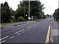
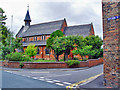
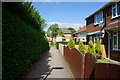
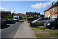
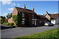
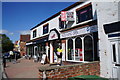
Photos of HU10 7AZ


Area Information
Living in HU10 7AZ offers a compact, residential experience shaped by its small footprint of 7.5 hectares and a population of 1,620. This postcode area is a quiet, tightly knit cluster of homes, predominantly occupied by adults aged 30–64, with a median age of 47. The high home ownership rate of 92% suggests a stable community where most residents live in their own properties. Daily life here is defined by proximity to essential services, including five retail outlets like Morrisons and Tesco, and rail stations such as Hessle and Cottingham, which link the area to broader networks. The low crime risk score of 72 and minimal flood risk make it an appealing choice for those prioritising safety. While the area lacks natural landscapes like AONBs or protected woodlands, its practical amenities and straightforward infrastructure cater to a lifestyle focused on convenience rather than rural tranquillity. For buyers, HU10 7AZ represents a small, well-serviced neighbourhood where community ties are likely strong, and the absence of planning constraints allows for straightforward property transactions.
- Area Type
- Postcode
- Area Size
- 7.5 hectares
- Population
- 1620
- Population Density
- 729 people/km²
The property market in HU10 7AZ is characterised by high home ownership, with 92% of residents living in their own homes. This suggests a market dominated by owner-occupiers rather than rental properties, which may limit availability for buyers seeking to rent. The accommodation type is exclusively houses, indicating a lack of apartments or flats, which could appeal to those prioritising space and privacy. Given the area’s small size of 7.5 hectares and population of 1,620, the housing stock is likely limited, making properties in HU10 7AZ relatively scarce. Buyers should consider the proximity to nearby amenities, such as schools and rail stations, which enhance the area’s practicality. However, the absence of planning constraints like protected woodlands or AONBs means development restrictions are minimal, potentially offering opportunities for property growth. For those seeking a quiet, stable environment with straightforward ownership, this area may be a viable option.
House Prices in HU10 7AZ
Showing 2 properties
| Address | Type | Beds | Baths | Last Sale Price | Last Sale Date | |
|---|---|---|---|---|---|---|
| Blackberry Clinic, Spire Hospital, Lowfield Road, Anlaby, HU10 7AZ | commercial | - | - | - | - | |
| North Of England Hyperbaric Services Limited, Spire Hospital, Lowfield Road, Anlaby, HU10 7AZ | commercial | - | - | - | - |
Energy Efficiency in HU10 7AZ
Residents of HU10 7AZ enjoy a range of nearby amenities, including five retail outlets such as Morrisons, Sainsburys, and Tesco, which provide everyday shopping convenience. The area’s rail stations—Hessle, North Ferriby, and Cottingham—offer easy access to public transport, linking the community to surrounding towns and cities. Brough Airport, though not a major international hub, provides an alternative for air travel. While the data does not mention parks or leisure facilities, the presence of multiple retail and transport options suggests a lifestyle focused on practicality and connectivity. The compact nature of the area means amenities are within practical reach, reducing the need for long commutes. This combination of retail, transport, and proximity to rail networks supports a convenient, community-oriented lifestyle, ideal for those prioritising accessibility over expansive recreational spaces.
Amenities
Schools
Residents of HU10 7AZ have access to two independent schools: Tranby and Hull Preparatory School. Both institutions cater to private education, offering structured learning environments for families prioritising this option. The absence of state-funded schools in the immediate vicinity means the area’s educational landscape is exclusively private. This may benefit households seeking specific curricula or facilities not typically available in state schools, but it could pose challenges for those requiring free or subsidised education. The proximity of these schools to the area underscores their role as key draws for families, though buyers should verify whether the schools’ admission policies align with their needs. The lack of state school options may also influence the local community’s demographic profile, attracting households with the means to afford private education.
| Rank | School | Type | Entry gender | Ages |
|---|
Explore more schools in this area
Go to Schools tabDemographics
The community in HU10 7AZ is predominantly composed of adults aged 30–64, with a median age of 47. This suggests a mature, established population, likely with long-term ties to the area. The high home ownership rate of 92% indicates a stable demographic, with few renters, and the accommodation type is exclusively houses, reflecting a lack of flats or apartments. The predominant ethnic group is White, though no specific data on diversity or deprivation is provided. With a population density of 729 people per square kilometre, the area is moderately populated for its size, balancing residential density with the space of 7.5 hectares. The age profile implies a community focused on family life and long-term residence, with fewer young families or elderly residents compared to areas with broader age ranges. This demographic structure may influence local services and amenities, which are tailored to the needs of middle-aged households.
Household Size
Accommodation Type
Tenure
Ethnic Group
Religion
Household Composition
Age
Household Deprivation
NS-SEC
Explore more demographic insights in this area
Go to Demographics tabPlanning
Planning Constraints
- Flood RiskPremium
- Ramsar Wetland SitesPremium
- Area of Outstanding Natural BeautyPremium
- Protected Nature ReservePremium
- Protected WoodlandPremium