Area Overview for HU10 7AH
Photos of HU10 7AH
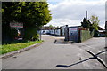
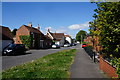
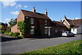
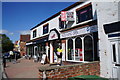
83 photos from this area
Area Information
Key information about the HU10 7AH including its size, population, and administrative classification.
- Area Type
- Postcode
- Area Size
- 9829 m²
- Population
- 1620
- Population Density
- 729 people/km²
House Prices in HU10 7AH
17
Properties
£232,542
Average Sold Price
£76,500
Lowest Price
£388,000
Highest Price
Showing 17 properties
| Address | Type | Beds | Baths | Last Sale Price | Last Sale Date | |
|---|---|---|---|---|---|---|
| 307 Beverley Road, Anlaby, HU10 7AH | Semi-detached | 4 | 2 | £388,000 | May 2023 | |
| 289 Beverley Road, Anlaby, HU10 7AH | Detached | 4 | 2 | £388,000 | Jan 2022 | |
| 305 Beverley Road, Anlaby, HU10 7AH | Semi-detached | 4 | 1 | £365,000 | Aug 2021 | |
| 319 Beverley Road, Anlaby, HU10 7AH | Bungalow | 2 | 1 | £215,000 | Oct 2020 | |
| 297 Beverley Road, Anlaby, HU10 7AH | Semi-detached | 4 | 1 | £250,000 | Apr 2017 | |
| 309 Beverley Road, Anlaby, HU10 7AH | house | 4 | - | £240,000 | Sep 2010 | |
| 315 Beverley Road, Anlaby, HU10 7AH | Detached | - | - | £210,000 | Oct 2005 | |
| 313 Beverley Road, Anlaby, HU10 7AH | Semi-detached | 4 | 1 | £250,000 | Sep 2005 | |
| 317 Beverley Road, Anlaby, HU10 7AH | house | 3 | - | £190,000 | Apr 2004 | |
| 311 Beverley Road, Anlaby, HU10 7AH | house | - | - | £139,500 | May 2001 |
Page 1 of 2
Energy Efficiency in HU10 7AH
Amenities
Schools
| Rank | School | Type | Entry gender | Ages |
|---|
Explore more schools in this area
Go to Schools tabDemographics
Household Size
Two person
most common
Accommodation Type
Houses
most common
Tenure
92
majority
Ethnic Group
White
most common
Religion
N/A
most common
Household Composition
N/A
most common
Age
47
median
Adults (30-64 years)
most common
Household Deprivation
N/A
with no deprivation
NS-SEC
45
in Lower managerial occupations
Explore more demographic insights in this area
Go to Demographics tabPlanning
Planning Constraints
- Flood RiskPremium
- Ramsar Wetland SitesPremium
- Area of Outstanding Natural BeautyPremium
- Protected Nature ReservePremium
- Protected WoodlandPremium