Area Overview for HU10 7AD
Photos of HU10 7AD
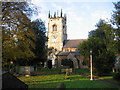
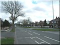
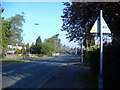
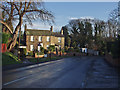
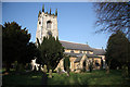
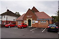
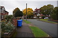
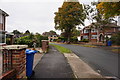
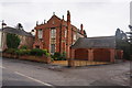
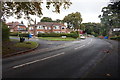
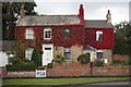
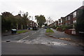
63 photos from this area
Area Information
Key information about the HU10 7AD including its size, population, and administrative classification.
- Area Type
- Postcode
- Area Size
- 2.0 hectares
- Population
- 1481
- Population Density
- 2661 people/km²
House Prices in HU10 7AD
21
Properties
£318,294
Average Sold Price
£109,000
Lowest Price
£715,000
Highest Price
Showing 21 properties
| Address | Type | Beds | Baths | Last Sale Price | Last Sale Date | |
|---|---|---|---|---|---|---|
| 24 Wolfreton Garth, Kirk Ella, HU10 7AD | Bungalow | 2 | 2 | £350,000 | Jul 2023 | |
| 10 Wolfreton Garth, Kirk Ella, HU10 7AD | Bungalow | 4 | 2 | £435,000 | Feb 2023 | |
| 2 Wolfreton Garth, Kirk Ella, HU10 7AD | Detached | 5 | - | £355,000 | Dec 2022 | |
| 32 Wolfreton Garth, Kirk Ella, HU10 7AD | Detached | 4 | 3 | £535,000 | Aug 2022 | |
| 22 Wolfreton Garth, Kirk Ella, HU10 7AD | house | - | - | £375,000 | Sep 2021 | |
| 36 Wolfreton Garth, Kirk Ella, HU10 7AD | Bungalow | - | - | £315,000 | Feb 2021 | |
| 14 Wolfreton Garth, Kirk Ella, HU10 7AD | Bungalow | 2 | - | £715,000 | Nov 2020 | |
| 42 Wolfreton Garth, Kirk Ella, HU10 7AD | Bungalow | 4 | 2 | £320,000 | Sep 2014 | |
| 4 Wolfreton Garth, Kirk Ella, HU10 7AD | Detached | 4 | 3 | £245,000 | Nov 2011 | |
| 40 Wolfreton Garth, Kirk Ella, HU10 7AD | Bungalow | 3 | - | £250,000 | Apr 2010 |
Page 1 of 3
Energy Efficiency in HU10 7AD
Amenities
Schools
| Rank | School | Type | Entry gender | Ages |
|---|
Explore more schools in this area
Go to Schools tabDemographics
Household Size
Two person
most common
Accommodation Type
Houses
most common
Tenure
91
majority
Ethnic Group
White
most common
Religion
N/A
most common
Household Composition
N/A
most common
Age
47
median
Adults (30-64 years)
most common
Household Deprivation
N/A
with no deprivation
NS-SEC
44
in Lower managerial occupations
Explore more demographic insights in this area
Go to Demographics tabPlanning
Planning Constraints
- Flood RiskPremium
- Ramsar Wetland SitesPremium
- Area of Outstanding Natural BeautyPremium
- Protected Nature ReservePremium
- Protected WoodlandPremium