Area Overview for HU10 6YR
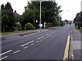
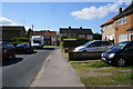
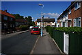
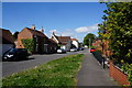
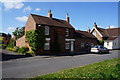
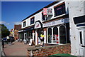
Photos of HU10 6YR


Area Information
Living in HU10 6YR offers a quiet, residential experience in a small cluster of homes with a tight-knit community feel. The area’s population of 1,423 residents suggests a compact, manageable environment where neighbours are likely to be familiar faces. With a median age of 47 and a majority of residents aged 30–64, the community leans towards mature, established households. The area’s focus on owner-occupied homes—69% of properties are owned by residents—points to a stable, long-term demographic. Daily life here is likely characterised by a balance between local amenities and proximity to transport links. While the area itself is small, its placement near rail stations and retail hubs means residents can access broader services without needing to travel far. The absence of significant environmental constraints, such as protected natural areas, means development and living here feels unencumbered by restrictive planning rules. For those seeking a peaceful yet connected lifestyle, HU10 6YR provides a blend of simplicity and accessibility.
- Area Type
- Postcode
- Area Size
- Not available
- Population
- 1423
- Population Density
- 3784 people/km²
The property market in HU10 6YR is defined by a high rate of home ownership—69% of properties are owner-occupied—suggesting a community of long-term residents rather than a transient rental market. The accommodation type is predominantly houses, which may indicate a preference for family homes or larger living spaces. This focus on owner-occupied housing means the area is less likely to be dominated by short-term lets or investment properties. For buyers, this small cluster of homes implies limited options within the postcode itself, but the proximity to nearby areas may offer additional choices. The absence of restrictive planning constraints, such as protected natural sites, could make the area more appealing for those seeking to purchase or renovate without regulatory hurdles. However, the limited size of the area means that buyers should consider the surrounding regions for a broader range of properties.
House Prices in HU10 6YR
No properties found in this postcode.
Energy Efficiency in HU10 6YR
Residents of HU10 6YR have access to a range of amenities within practical reach. Local retail options include Sainsburys Anlaby, Morrisons Kirk, and M&S Anlaby Hull SF, providing everyday shopping convenience. The area’s proximity to rail stations such as Hessle, Cottingham, and North Ferriby enhances mobility, allowing easy access to broader services and employment opportunities. For those requiring air travel, Brough Airport is a nearby option. While the area itself is small, its connection to these amenities ensures a balance between local convenience and regional accessibility. The presence of multiple retail outlets and transport links suggests a lifestyle that combines the ease of daily errands with the flexibility to travel further afield. This mix of practicality and connectivity supports a comfortable, well-served community.
Amenities
Schools
| Rank | School | Type | Entry gender | Ages |
|---|
Explore more schools in this area
Go to Schools tabDemographics
The community in HU10 6YR is predominantly composed of adults aged 30–64, with a median age of 47. This suggests a population that is largely in their prime working years, with families and established careers. Home ownership is high at 69%, indicating a strong presence of long-term residents who have invested in their properties. The accommodation type is primarily houses, which aligns with the area’s residential character and may appeal to those seeking more space than flats. The predominant ethnic group is White, reflecting the broader demographic patterns of the region. While no specific data on deprivation is provided, the high home ownership rate and stable age profile imply a relatively stable economic environment. This demographic structure likely supports a community with shared interests and a focus on local amenities and services.
Household Size
Accommodation Type
Tenure
Ethnic Group
Religion
Household Composition
Age
Household Deprivation
NS-SEC
Explore more demographic insights in this area
Go to Demographics tabPlanning
Planning Constraints
- Flood RiskPremium
- Ramsar Wetland SitesPremium
- Area of Outstanding Natural BeautyPremium
- Protected Nature ReservePremium
- Protected WoodlandPremium