Area Overview for HU10 6WY
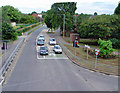
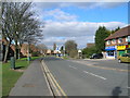
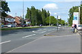
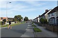
Photos of HU10 6WY


Area Information
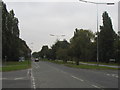
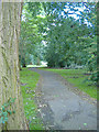
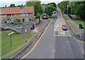
Living in HU10 6WY offers a quiet, residential lifestyle in a small cluster of homes with a population of 1,420. The area is characterised by its mature demographic, with residents predominantly aged 30–64 and a median age of 47. This suggests a stable community where many residents are likely to be established professionals or families. The housing stock is largely composed of owner-occupied homes, with 69% of properties owned by residents. The area’s proximity to Hessle and its surrounding amenities, including retail and transport links, makes it a practical choice for those seeking a balance between seclusion and accessibility. With low flood risk and a crime score of 68, safety is a notable feature. While the area is small, its connections to nearby towns via rail and ferry services provide flexibility for commuters. HU10 6WY is not a sprawling suburb but a compact, well-defined postcode where daily life is shaped by local shops, schools, and transport options.
- Area Type
- Postcode
- Area Size
- Not available
- Population
- 1420
- Population Density
- 5316 people/km²
The property market in HU10 6WY is dominated by owner-occupied homes, with 69% of properties owned by residents. This suggests a stable, low-turnover market where properties are likely to remain in the same hands for extended periods. The accommodation type is primarily houses, which is uncommon in many urban areas but typical of smaller, rural or semi-rural postcodes. This means the housing stock is likely to be older, with fewer high-rise developments or rental-focused properties. For buyers, this translates to a market where demand may outstrip supply, given the small size of the area. The lack of rental properties also indicates that the area is not a hotspot for investors seeking yield. Prospective buyers should consider the limited scope for new developments, as the area’s planning constraints and small size may restrict expansion.
House Prices in HU10 6WY
No properties found in this postcode.
Energy Efficiency in HU10 6WY
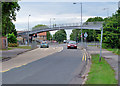
The lifestyle in HU10 6WY is shaped by its access to nearby amenities, including five retail outlets such as Tesco Hessle Boothferry, Sainsburys Bethune, and Morrisons Daily. These shops provide convenience for everyday shopping, while the presence of multiple rail stations—Hessle, Barrow Haven, and Hull—offers easy access to urban centres. A ferry terminal at Hull adds maritime connectivity, and Brough Airport provides regional travel options. Though the area is small, its proximity to these facilities ensures residents are not isolated. The mix of retail, transport, and travel options creates a practical, community-oriented lifestyle. While there are no named parks or leisure facilities in the data, the area’s low crime rate and quiet residential character suggest a peaceful environment for daily life.
Amenities
Schools
The nearest school to HU10 6WY is Hessle Penshurst Primary School, which serves the local community. The data lists this school twice, but it is the only primary school in the immediate area. While there is no Ofsted rating provided, the presence of a primary school suggests the area is suitable for families with young children. However, the absence of secondary schools or further education institutions means families may need to look beyond HU10 6WY for comprehensive schooling. This could be a consideration for those prioritising a full range of educational options. The single primary school may also indicate limited competition for places, though this depends on the school’s capacity and local demand.
| Rank | School | Type | Entry gender | Ages |
|---|---|---|---|---|
| 1 | Hessle Penshurst Primary School | primary | N/A | N/A |
| 2 | Hessle Penshurst Primary School | primary | N/A | N/A |
Explore more schools in this area
Go to Schools tabDemographics
The community in HU10 6WY is predominantly composed of adults aged 30–64, with a median age of 47. This suggests a population that is largely settled, with fewer young families or elderly residents compared to other areas. Home ownership is high, at 69%, indicating a strong presence of long-term residents. The accommodation type is primarily houses, which aligns with the area’s residential character. The predominant ethnic group is White, reflecting a homogenous demographic profile. There is no data on deprivation levels, but the high home ownership and low crime score of 68 suggest a relatively stable and secure environment. The absence of significant diversity metrics means the community’s social fabric is likely shaped by local traditions and established networks. For buyers, this demographic profile implies a mature, low-maintenance market with fewer transient residents.
Household Size
Accommodation Type
Tenure
Ethnic Group
Religion
Household Composition
Age
Household Deprivation
NS-SEC
Explore more demographic insights in this area
Go to Demographics tabPlanning
Planning Constraints
- Flood RiskPremium
- Ramsar Wetland SitesPremium
- Area of Outstanding Natural BeautyPremium
- Protected Nature ReservePremium
- Protected WoodlandPremium
- Crime RiskPremium