Area Overview for HU10 6PZ
Photos of HU10 6PZ


Area Information
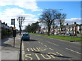
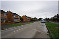
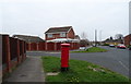
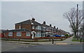
Living in HU10 6PZ means being part of a tightly knit residential cluster in England, home to 1,394 residents. This small area is characterised by its modest scale and straightforward layout, ideal for those seeking a quiet, low-maintenance lifestyle. The population is predominantly adults aged 30–64, with a median age of 47, suggesting a stable community with established families and professionals. Most homes are owner-occupied, reflecting a sense of permanence. The area’s proximity to key transport links, including rail stations and a ferry terminal, ensures easy access to nearby towns and cities. Daily life here is shaped by local amenities, from retail outlets to schools, and the absence of major environmental constraints like protected woodlands or flood-prone zones. While it lacks the vibrancy of larger urban centres, HU10 6PZ offers a calm, functional environment for those prioritising security, simplicity, and practicality.
- Area Type
- Postcode
- Area Size
- Not available
- Population
- 1394
- Population Density
- 3979 people/km²
The property market in HU10 6PZ is dominated by owner-occupied homes, with 81% of properties owned outright. This high home ownership rate suggests a community of long-term residents rather than a transient rental market. The accommodation type is primarily houses, which is unusual for areas with higher apartment or flat density. Given the area’s small size, the housing stock is limited, making it a niche market for buyers seeking a quiet, low-traffic environment. The predominance of houses may appeal to those prioritising space and privacy over urban convenience. However, the lack of rental properties means the market is less dynamic, with fewer options for those seeking to move quickly or test the area before committing.
House Prices in HU10 6PZ
No properties found in this postcode.
Energy Efficiency in HU10 6PZ
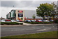
The lifestyle in HU10 6PZ is shaped by its access to essential amenities within practical reach. Local retail options include M&S Anlaby Hull, Asda Living, and Heron Hotham, offering a mix of shopping and dining choices. The presence of five rail stations and a ferry terminal ensures convenient travel for work, leisure, or commuting. While the area lacks large parks or entertainment venues, its proximity to transport links and retail hubs supports a functional daily life. The modest scale of the area means amenities are concentrated, requiring minimal travel for essentials. This balance of convenience and simplicity suits those prioritising practicality over sprawling urban experiences.
Amenities
Schools
The nearest school to HU10 6PZ is Springhead Primary School, which holds a ‘good’ Ofsted rating. This primary school serves the local community, offering education for younger children. The absence of secondary schools or further education institutions in the immediate vicinity means families may need to consider commuting for older children’s schooling. However, the ‘good’ rating indicates that the primary education available meets acceptable standards. For parents prioritising proximity to schools, Springhead Primary provides a reliable option, though the limited range of educational institutions may influence decisions for those requiring a broader selection of schools.
| Rank | School | Type | Entry gender | Ages |
|---|
Explore more schools in this area
Go to Schools tabDemographics
The community in HU10 6PZ is predominantly composed of adults aged 30–64, with a median age of 47. This suggests a mature, settled population, likely with strong ties to the area. Home ownership is high, at 81%, indicating that most residents are long-term residents rather than renters. The accommodation is primarily houses, which aligns with the area’s small-scale, residential character. The predominant ethnic group is White, though no specific data on diversity or deprivation is provided. The age profile implies a community focused on stability, with fewer young families or elderly residents compared to other areas. This demographic structure likely influences local services and amenities, which cater to middle-aged adults and their needs.
Household Size
Accommodation Type
Tenure
Ethnic Group
Religion
Household Composition
Age
Household Deprivation
NS-SEC
Explore more demographic insights in this area
Go to Demographics tabPlanning
Planning Constraints
- Flood RiskPremium
- Ramsar Wetland SitesPremium
- Area of Outstanding Natural BeautyPremium
- Protected Nature ReservePremium
- Protected WoodlandPremium