Area Overview for HU10 6FL
Photos of HU10 6FL


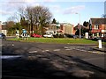
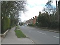
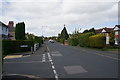
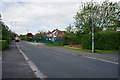


66 photos from this area
Area Information
Key information about the HU10 6FL including its size, population, and administrative classification.
- Area Type
- Postcode
- Area Size
- 6814 m²
- Population
- 1442
- Population Density
- 1619 people/km²
House Prices in HU10 6FL
11
Properties
£258,814
Average Sold Price
£222,500
Lowest Price
£299,950
Highest Price
Showing 11 properties
| Address | Type | Beds | Baths | Last Sale Price | Last Sale Date | |
|---|---|---|---|---|---|---|
| 21 Great Gutter Lane East, Willerby, HU10 6FL | Terraced | 3 | 2 | £265,000 | May 2025 | |
| 15 Great Gutter Lane East, Willerby, HU10 6FL | Semi-detached | 3 | 2 | £287,500 | Aug 2024 | |
| 17 Great Gutter Lane East, Willerby, HU10 6FL | house | 3 | - | £242,000 | Mar 2024 | |
| 27 Great Gutter Lane East, Willerby, HU10 6FL | Terraced | 3 | 2 | £258,000 | Dec 2022 | |
| 33 Great Gutter Lane East, Willerby, HU10 6FL | Terraced | 3 | 2 | £242,000 | Apr 2021 | |
| 35 Great Gutter Lane East, Willerby, HU10 6FL | house | 4 | - | £299,950 | Aug 2020 | |
| 25 Great Gutter Lane East, Willerby, HU10 6FL | Terraced | 4 | 2 | £285,000 | May 2018 | |
| 31 Great Gutter Lane East, Willerby, HU10 6FL | Terraced | 3 | 3 | £230,000 | Sep 2017 | |
| 19 Great Gutter Lane East, Willerby, HU10 6FL | Semi-detached | 3 | 2 | £222,500 | Dec 2016 | |
| 23 Great Gutter Lane East, Willerby, HU10 6FL | house | - | - | £290,000 | May 2012 |
Page 1 of 2
Energy Efficiency in HU10 6FL
Amenities
Schools
| Rank | School | Type | Entry gender | Ages |
|---|
Explore more schools in this area
Go to Schools tabDemographics
Household Size
Two person
most common
Accommodation Type
Houses
most common
Tenure
89
majority
Ethnic Group
White
most common
Religion
N/A
most common
Household Composition
N/A
most common
Age
47
median
Adults (30-64 years)
most common
Household Deprivation
N/A
with no deprivation
NS-SEC
41
in Lower managerial occupations
Explore more demographic insights in this area
Go to Demographics tabPlanning
Planning Constraints
- Flood RiskPremium
- Ramsar Wetland SitesPremium
- Area of Outstanding Natural BeautyPremium
- Protected Nature ReservePremium
- Protected WoodlandPremium