Area Overview for HU10 6AJ
Photos of HU10 6AJ
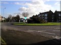
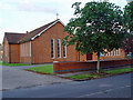
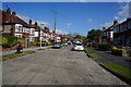
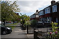
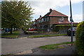
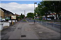
71 photos from this area
Area Information
Key information about the HU10 6AJ including its size, population, and administrative classification.
- Area Type
- Postcode
- Area Size
- 1.3 hectares
- Population
- 1380
- Population Density
- 489 people/km²
House Prices in HU10 6AJ
40
Properties
£107,979
Average Sold Price
£30,000
Lowest Price
£200,000
Highest Price
Showing 40 properties
| Address | Type | Beds | Baths | Last Sale Price | Last Sale Date | |
|---|---|---|---|---|---|---|
| 29 Trafford Road, Willerby, HU10 6AJ | Terraced | 3 | 1 | £164,000 | Mar 2025 | |
| 36 Trafford Road, Willerby, HU10 6AJ | Semi-detached | 3 | 1 | £200,000 | Sep 2023 | |
| 28 Trafford Road, Willerby, HU10 6AJ | Terraced | - | - | £140,000 | Sep 2021 | |
| 22 Trafford Road, Willerby, HU10 6AJ | Terraced | 3 | 1 | £133,000 | Sep 2021 | |
| 4 Trafford Road, Willerby, HU10 6AJ | house | 3 | 1 | £145,000 | Mar 2021 | |
| 35 Trafford Road, Willerby, HU10 6AJ | house | - | - | £148,000 | Mar 2020 | |
| 32 Trafford Road, Willerby, HU10 6AJ | Terraced | 3 | 1 | £160,000 | Jun 2019 | |
| 21 Trafford Road, Willerby, HU10 6AJ | Terraced | 3 | 1 | £133,000 | Jul 2017 | |
| 39 Trafford Road, Willerby, HU10 6AJ | house | - | - | £149,950 | Jun 2014 | |
| 2 Trafford Road, Willerby, HU10 6AJ | Terraced | 3 | - | £119,000 | Oct 2013 |
Page 1 of 4
Energy Efficiency in HU10 6AJ
Amenities
Schools
| Rank | School | Type | Entry gender | Ages |
|---|
Explore more schools in this area
Go to Schools tabDemographics
Household Size
Two person
most common
Accommodation Type
Houses
most common
Tenure
94
majority
Ethnic Group
White
most common
Religion
N/A
most common
Household Composition
N/A
most common
Age
47
median
Elderly (65+ years)
most common
Household Deprivation
N/A
with no deprivation
NS-SEC
35
in Lower managerial occupations
Explore more demographic insights in this area
Go to Demographics tabPlanning
Planning Constraints
- Flood RiskPremium
- Ramsar Wetland SitesPremium
- Area of Outstanding Natural BeautyPremium
- Protected Nature ReservePremium
- Protected WoodlandPremium