Area Overview for HU1 3TF
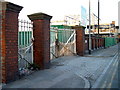
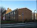
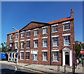
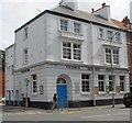
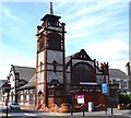
Photos of HU1 3TF


Area Information
Living in HU1 3TF means inhabiting a tightly packed residential cluster in England’s East Riding, where 1,420 people reside within just 3,339 square metres. This density creates a compact, densely populated environment, typical of urban or semi-urban settings. The area is defined by its small scale, with residents likely to know their neighbours closely. Daily life here is shaped by proximity to amenities, with five retail outlets, including Iceland Hull and Morrisons Daily, and five rail stations within reach. The area’s proximity to Hull Railway Station and the Hull Ferry Terminal offers strong connectivity for commuting or leisure travel. However, the high population density and limited space mean the area is more suited to those prioritising convenience over expansive living. With a median age of 47 and a population skewed toward adults aged 30–64, the community is mature and likely to value stability. Despite its small size, HU1 3TF offers access to essential services, though its challenges—such as flood risk and crime—must be weighed against its practical advantages.
- Area Type
- Postcode
- Area Size
- 3339 m²
- Population
- 1420
- Population Density
- 2113 people/km²
The property market in HU1 3TF is characterised by a very low home ownership rate of 16%, suggesting that the area is predominantly a rental market. Flats are the primary accommodation type, which aligns with the compact nature of the postcode and its high population density. This makes HU1 3TF unsuitable for buyers seeking long-term ownership, as the housing stock is limited to smaller, rented units. The small area size and surrounding proximity mean property options are scarce, with little scope for expansion or development. For those considering the area, the focus should be on rental opportunities rather than investment in property. The lack of owner-occupied homes also implies that the community is transient, with residents potentially moving frequently. Buyers should be aware that the market is not geared toward homeownership, and any purchase would likely be speculative or for short-term use.
House Prices in HU1 3TF
No properties found in this postcode.
Energy Efficiency in HU1 3TF
Residents of HU1 3TF have access to a range of essential amenities within practical reach, including five retail outlets such as Iceland Hull and Morrisons Daily, which provide grocery and household needs. The area’s rail network, with stations like Hull Railway Station and New Holland Railway Station, offers easy access to commuting and regional travel. The Hull Ferry Terminal adds another layer of connectivity, particularly for those using water transport. While the area lacks expansive parks or leisure facilities, its compact nature ensures that daily essentials are never far. The presence of multiple retail and transport hubs suggests a practical, no-frills lifestyle, ideal for those prioritising convenience over luxury. The limited availability of leisure or recreational spaces may require residents to travel slightly further for activities like dining out or cultural events. Overall, HU1 3TF caters to a functional, community-oriented lifestyle with a focus on accessibility and proximity to services.
Amenities
Schools
Residents of HU1 3TF have access to two schools within practical reach: Hull Trinity House School, a primary school, and TLG Hull, an independent school. These options cater to different educational preferences, with the primary school serving younger children and the independent school offering alternative fee-paying education. The presence of both public and private schooling provides families with choices, though the data does not specify Ofsted ratings or academic performance. For parents prioritising state education, Hull Trinity House School is a nearby option, while those seeking independent schooling can access TLG Hull. The limited number of schools suggests that families may need to travel further for secondary education or specialist provisions. The mix of school types reflects a community that values both public and private education options, though the overall availability remains constrained by the area’s small size.
| Rank | School | Type | Entry gender | Ages |
|---|
Explore more schools in this area
Go to Schools tabDemographics
The demographic profile of HU1 3TF is marked by a median age of 47, with the majority of residents falling within the 30–64 age range. This suggests a community of working-age adults, possibly with families or those in established careers. Home ownership is exceptionally low at 16%, indicating that most residents are renters, likely in flats given the accommodation type data. The predominant ethnic group is White, with no specific data on other demographics provided. The high population density of 425,281 people per square kilometre implies a tightly packed living environment, which may influence social dynamics and access to shared spaces. While this density can foster a sense of community, it also raises questions about housing quality and privacy. The absence of detailed diversity statistics means the area’s cultural composition remains less defined, but the data underscores a population that is largely middle-aged, renting, and living in flats.
Household Size
Accommodation Type
Tenure
Ethnic Group
Religion
Household Composition
Age
Household Deprivation
NS-SEC
Explore more demographic insights in this area
Go to Demographics tabPlanning
Planning Constraints
- Flood RiskPremium
- Ramsar Wetland SitesPremium
- Area of Outstanding Natural BeautyPremium
- Protected Nature ReservePremium
- Protected WoodlandPremium