Area Overview for HU1 3SJ
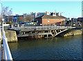
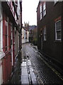
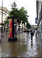
Photos of HU1 3SJ


Area Information
Living in HU1 3SJ means being part of a small, tightly knit residential cluster in England, home to 1,420 residents. This postcode area is compact, with a quiet, community-focused atmosphere. Its proximity to key amenities and transport links makes it practical for daily life, while the surrounding environment offers a balance of local services and broader connectivity. Residents benefit from nearby schools, retail outlets, and rail networks, which are essential for both commuters and families. The area’s small size means a strong sense of familiarity, with local landmarks and services within easy reach. While it lacks large-scale infrastructure, its charm lies in its accessibility and the ease of navigating daily routines. The postcode’s low flood risk and absence of protected natural areas suggest a stable, low-constraint environment for development and living. For those seeking a manageable, well-served community, HU1 3SJ provides a foundation of practicality and convenience.
- Area Type
- Postcode
- Area Size
- Not available
- Population
- 1420
- Population Density
- 2113 people/km²
The property market in HU1 3SJ reflects its small, residential character. While specific home ownership percentages are not provided, the area’s compact nature suggests a mix of owner-occupied and rental properties. The lack of large-scale housing developments points to a focus on modest, family-friendly homes. Given the limited data, it is unclear whether the area is predominantly owner-occupied or rental-focused. However, the proximity to rail stations and retail amenities may appeal to both long-term residents and investors seeking affordable, accessible housing. Buyers should consider the area’s size and the potential for limited property diversity when evaluating options.
House Prices in HU1 3SJ
No properties found in this postcode.
Energy Efficiency in HU1 3SJ
Residents of HU1 3SJ enjoy a range of nearby amenities, including five retail outlets such as Tesco King, Morrisons Daily, and Iceland Hull. These shops provide everyday convenience for groceries and household needs. The rail stations and ferry terminal enhance mobility, while the absence of major leisure or recreational facilities suggests a focus on practical living over large-scale entertainment. The area’s compact nature means amenities are within walking or short driving distance, contributing to a lifestyle that prioritizes accessibility and efficiency.
Amenities
Schools
Residents of HU1 3SJ have access to Hull Trinity House School, a primary school, and TLG Hull, an independent institution. These options cater to both state and private education needs, offering families flexibility in choosing their children’s schooling. The presence of a primary school suggests a focus on local, community-based education, while the independent school provides an alternative for those seeking specialized curricula or smaller class sizes. The combination of school types indicates a range of educational priorities within the area, though specific Ofsted ratings or performance data are not included in the provided information.
| Rank | School | Type | Entry gender | Ages |
|---|
Explore more schools in this area
Go to Schools tabDemographics
HU1 3SJ has a population of 1,420, though specific data on age distribution, household types, or diversity is not provided. The area’s small size suggests a relatively uniform demographic profile, with no indication of significant variation in age or household composition. The lack of detailed figures means assumptions about the community’s structure cannot be made. However, the presence of both primary and independent schools implies a mix of family-oriented residents and those seeking private education options. The absence of deprivation statistics in the data means quality of life factors such as income levels or social needs are not quantified. This postcode remains a practical, low-profile residential area without explicit markers of demographic complexity.
Household Size
Accommodation Type
Tenure
Ethnic Group
Religion
Household Composition
Age
Household Deprivation
NS-SEC
Explore more demographic insights in this area
Go to Demographics tabPlanning
Planning Constraints
- Flood RiskPremium
- Ramsar Wetland SitesPremium
- Area of Outstanding Natural BeautyPremium
- Protected Nature ReservePremium
- Protected WoodlandPremium