Area Overview for HU1 3DT
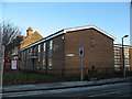
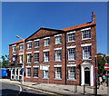
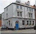
Photos of HU1 3DT


Area Information
Living in HU1 3DT means inhabiting a compact, densely populated postcode area in England’s East Riding, where 1,484 residents occupy just 1,119 square metres. This small cluster is defined by its proximity to Hull’s urban core, with easy access to rail networks and the Hull Ferry Terminal, which connects to the Isle of Dogs. The area’s character is shaped by its demographic profile: a median age of 47, with adults aged 30–64 forming the majority. Daily life here is influenced by the high population density of 1,326,643 people per square kilometre, creating a tightly knit, possibly transient community. While the area lacks green spaces or protected landscapes, its strategic location near multiple railway stations and retail hubs offers practical convenience. However, residents must contend with critical flood risk and above-average crime rates, which demand careful consideration. For those prioritising connectivity and proximity to urban amenities, HU1 3DT offers a compact, functional living environment, albeit with notable safety challenges.
- Area Type
- Postcode
- Area Size
- 1119 m²
- Population
- 1484
- Population Density
- 2703 people/km²
The property market in HU1 3DT is characterised by low home ownership (16%) and a predominance of flats, indicating a rental-focused environment. This small postcode area likely consists of purpose-built or converted flats catering to tenants rather than owner-occupiers. The limited size of the area—just 1,119 square metres—means housing stock is constrained, potentially leading to competition for available properties. For buyers, this suggests a niche market where opportunities may be scarce, and prices could be influenced by proximity to transport links and amenities. The high population density implies that properties are likely to be smaller, with shared walls and communal facilities. Prospective buyers should consider the area’s safety risks, including critical flood and crime ratings, which may affect property desirability and long-term investment potential.
House Prices in HU1 3DT
No properties found in this postcode.
Energy Efficiency in HU1 3DT
Residents of HU1 3DT benefit from nearby retail options, including Tesco King, Heron Hull, and Morrisons Daily, providing essential shopping within practical reach. The area’s rail links to Hull, New Holland, and Cottingham stations offer access to broader urban amenities, while the Hull Ferry Terminal connects to the Isle of Dogs, expanding leisure and employment opportunities. Though the data does not mention parks or leisure facilities, the proximity to urban hubs suggests a lifestyle centred on convenience rather than natural recreation. The compact nature of the area means amenities are tightly clustered, which can be both efficient and limiting, depending on individual preferences. For those prioritising accessibility over expansive green spaces, HU1 3DT’s practical layout supports a straightforward, utilitarian daily life, albeit within a densely populated setting.
Amenities
Schools
Residents of HU1 3DT have access to a range of educational institutions, including Hull College, a sixth-form provider offering post-16 education, and Hull Studio School, a secondary school catering to younger students. Ron Dearing UTC, also a secondary school, holds an outstanding Ofsted rating, reflecting its high standards of teaching and facilities. This mix of school types provides options for families with children at different stages of education. The presence of a sixth-form college suggests the area supports students pursuing vocational or academic pathways beyond traditional secondary education. However, the absence of primary schools in the data means families may need to look further afield for early education. The outstanding rating at Ron Dearing UTC is a notable advantage, but the overall school landscape should be evaluated in context of the area’s broader resources.
| Rank | School | Type | Entry gender | Ages |
|---|
Explore more schools in this area
Go to Schools tabDemographics
The community in HU1 3DT is predominantly middle-aged, with a median age of 47 and 30–64-year-olds making up the most common age group. Home ownership is low, at just 16%, suggesting a rental-dominated market. The accommodation type is largely flats, reflecting the area’s high density and compact footprint. The predominant ethnic group is White, though specific data on diversity or deprivation is not provided. The population density of 1,326,643 people per square kilometre indicates a very tight living environment, which may influence social dynamics and housing pressures. For residents, this density could mean limited private outdoor space and a reliance on shared communal areas. The age profile suggests a stable, possibly working-age population, though the absence of data on family structures or income levels means the full picture of quality of life remains partially obscured.
Household Size
Accommodation Type
Tenure
Ethnic Group
Religion
Household Composition
Age
Household Deprivation
NS-SEC
Explore more demographic insights in this area
Go to Demographics tabPlanning
Planning Constraints
- Flood RiskPremium
- Ramsar Wetland SitesPremium
- Area of Outstanding Natural BeautyPremium
- Protected Nature ReservePremium
- Protected WoodlandPremium