Area Overview for HU1 3DG
Photos of HU1 3DG


Area Information
Living in HU1 3DG means inhabiting a compact, densely populated residential cluster in England. The area covers just 4 hectares, housing 1,484 people in a population density of 36,782 per square kilometre — a stark contrast to the UK average. This small postcode area is defined by its high concentration of flats, reflecting a community where home ownership is minimal, with only 16% of residents owning their homes. The area’s character is shaped by its proximity to transport hubs and educational institutions, making it a practical choice for commuters and families. Despite its size, HU1 3DG offers access to essential services, including retail outlets, rail stations, and a ferry terminal. The median age of 47 suggests a mature population, with most residents aged between 30 and 64. While the area lacks natural landscapes or protected sites, its connectivity and proximity to urban amenities make it a functional, if densely packed, living environment.
- Area Type
- Postcode
- Area Size
- 4.0 hectares
- Population
- 1484
- Population Density
- 2703 people/km²
The property market in HU1 3DG is dominated by rental flats, with home ownership limited to just 16% of residents. This suggests a market where private landlords and housing associations hold significant influence, rather than individual buyers. The compact size of the area — 4 hectares — means the housing stock is tightly concentrated, with little scope for expansion or new developments. The prevalence of flats indicates a lack of larger family homes, which may make the area less appealing to growing households. For buyers, the small size of HU1 3DG and its surrounding areas means competition for properties is likely to be fierce, with limited options for those seeking owner-occupied homes. The high population density and rental focus also suggest that property values may be driven more by demand for proximity to transport and amenities than by traditional factors like land availability.
House Prices in HU1 3DG
Showing 10 properties
Energy Efficiency in HU1 3DG
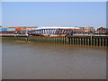
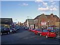
Residents of HU1 3DG benefit from a range of nearby amenities that support daily life. The area includes five retail outlets, such as Heron Hull, Tesco King, and Tesco Market, providing access to shopping, groceries, and other essentials. Rail stations offer convenient links to urban centres, while the Hull Ferry Terminal provides an alternative mode of transport for commuting or leisure. The compact nature of the area means these amenities are within practical reach, reducing the need for long journeys. The presence of multiple retail options and transport hubs contributes to a functional, if modest, lifestyle. While there is no mention of parks or recreational spaces in the data, the proximity to urban infrastructure suggests that entertainment and leisure opportunities are likely available in nearby districts. For those prioritising convenience and connectivity, HU1 3DG offers a practical, though not expansive, array of facilities.
Amenities
Schools
Residents of HU1 3DG have access to a range of educational institutions, including secondary schools and a sixth-form college. Hull Studio School and Ron Dearing UTC are both secondary schools, with the latter holding an Ofsted rating of outstanding. Hull College provides sixth-form education, catering to older students. This mix of school types ensures that families with children of varying ages can find suitable options within the area. The presence of an outstanding-rated secondary school is a notable advantage, though the absence of primary schools means younger children may require travel to nearby districts. The concentration of educational institutions reflects the area’s role as a hub for students and families reliant on these facilities. For parents, the proximity to these schools could be a key consideration, though the lack of primary education on-site may limit the appeal for those prioritising convenience.
| Rank | School | Type | Entry gender | Ages |
|---|
Explore more schools in this area
Go to Schools tabDemographics
The community in HU1 3DG is predominantly composed of adults aged 30 to 64, with a median age of 47. This suggests a population skewed towards working-age individuals, many of whom may be employed in nearby urban centres. Home ownership is exceptionally low at 16%, indicating that the majority of residents rent their accommodation. The area is characterised by flats, which dominate the housing stock, reflecting a lack of larger family homes or detached properties. The predominant ethnic group is White, though specific data on diversity or deprivation is not provided. The high population density, combined with the age profile, points to a community that may include professionals, retirees, and those in transitional life stages. The absence of detailed deprivation statistics means that the quality of life for residents is inferred from the availability of services and infrastructure rather than socioeconomic indicators.
Household Size
Accommodation Type
Tenure
Ethnic Group
Religion
Household Composition
Age
Household Deprivation
NS-SEC
Explore more demographic insights in this area
Go to Demographics tabPlanning
Planning Constraints
- Flood RiskPremium
- Ramsar Wetland SitesPremium
- Area of Outstanding Natural BeautyPremium
- Protected Nature ReservePremium
- Protected WoodlandPremium