Area Overview for HG5 9JS
Photos of HG5 9JS
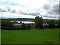
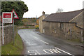
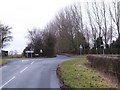

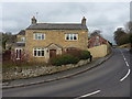
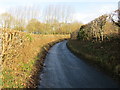
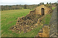
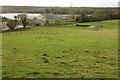
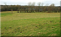


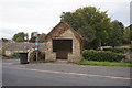
34 photos from this area
Area Information
Key information about the HG5 9JS including its size, population, and administrative classification.
- Area Type
- Postcode
- Area Size
- 20.4 hectares
- Population
- 1645
- Population Density
- 62 people/km²
House Prices in HG5 9JS
19
Properties
£589,385
Average Sold Price
£178,000
Lowest Price
£1,100,000
Highest Price
Showing 19 properties
| Address | Type | Beds | Baths | Last Sale Price | Last Sale Date | |
|---|---|---|---|---|---|---|
| Hunters Cottage, Farnham Lane, Farnham, HG5 9JS | house | - | - | £695,000 | Mar 2022 | |
| Poachers Cottage, Farnham Lane, Farnham, HG5 9JS | house | - | - | £725,000 | Jun 2021 | |
| Shepherds Cottage, Farnham Lane, Farnham, HG5 9JS | house | - | - | £710,000 | Jun 2021 | |
| Keepers Cottage, Farnham Lane, Farnham, HG5 9JS | house | - | - | £707,000 | Jun 2021 | |
| Throstle Nest Farm, Farnham Lane, Farnham, HG5 9JS | house | 4 | 3 | £1,100,000 | Feb 2021 | |
| Wheelhouse Farm, Farnham Lane, Farnham, HG5 9JS | house | - | - | £565,000 | Feb 2021 | |
| Thimble Cottage, 6 Farnham Lane, Farnham, HG5 9JS | Bungalow | 2 | - | £295,000 | Dec 2019 | |
| Lake View, Farnham Lane, Farnham, HG5 9JS | Detached | 5 | 3 | £820,000 | Nov 2019 | |
| The Halyard, Farnham Lane, Farnham, HG5 9JS | Detached | 5 | 3 | £925,000 | Jun 2019 | |
| Tiller Cottage, Farnham Lane, Farnham, HG5 9JS | Detached | 3 | 2 | £425,000 | May 2019 |
Page 1 of 2
Energy Efficiency in HG5 9JS
Amenities
Schools
| Rank | School | Type | Entry gender | Ages |
|---|
Explore more schools in this area
Go to Schools tabDemographics
Household Size
Two person
most common
Accommodation Type
Houses
most common
Tenure
83
majority
Ethnic Group
White
most common
Religion
N/A
most common
Household Composition
N/A
most common
Age
47
median
Adults (30-64 years)
most common
Household Deprivation
N/A
with no deprivation
NS-SEC
47
in Lower managerial occupations
Explore more demographic insights in this area
Go to Demographics tabPlanning
Planning Constraints
- Flood RiskPremium
- Ramsar Wetland SitesPremium
- Area of Outstanding Natural BeautyPremium
- Protected Nature ReservePremium
- Protected WoodlandPremium