Area Overview for HG5 9JG
Photos of HG5 9JG
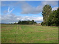
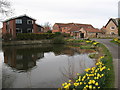
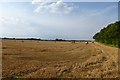
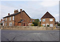
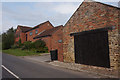
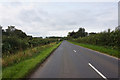
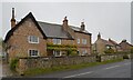
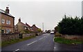
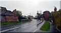
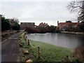
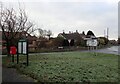
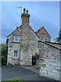
42 photos from this area
Area Information
Key information about the HG5 9JG including its size, population, and administrative classification.
- Area Type
- Postcode
- Area Size
- 40.8 hectares
- Population
- 1645
- Population Density
- 62 people/km²
House Prices in HG5 9JG
24
Properties
£421,119
Average Sold Price
£159,950
Lowest Price
£795,000
Highest Price
Showing 24 properties
| Address | Type | Beds | Baths | Last Sale Price | Last Sale Date | |
|---|---|---|---|---|---|---|
| New Barn House, Farnham Lane, Ferrensby, HG5 9JG | house | - | - | £700,000 | Sep 2021 | |
| Cross Roads, Farnham Lane, Ferrensby, HG5 9JG | house | 2 | - | £245,000 | Jul 2021 | |
| Alston, 9 Farnham Lane, Ferrensby, HG5 9JG | Detached | 4 | 2 | £527,500 | Feb 2020 | |
| Eastwood, Farnham Lane, Ferrensby, HG5 9JG | house | - | - | £795,000 | Nov 2015 | |
| Pond Cottage, Farnham Lane, Ferrensby, HG5 9JG | Detached | 4 | 2 | £299,950 | Aug 2015 | |
| Maple Croft, Farnham Lane, Ferrensby, HG5 9JG | Detached | 4 | - | £371,550 | Aug 2012 | |
| Lake View House, Farnham Lane, Ferrensby, HG5 9JG | Detached | - | - | £270,000 | Apr 2000 | |
| Sandiway, Farnham Lane, Ferrensby, HG5 9JG | Detached | - | - | £159,950 | Sep 1999 | |
| 2, Long Cottages, Farnham Lane, Ferrensby, HG5 9JG | Terraced | 2 | 1 | - | - | |
| Manderley, 5 Farnham Lane, Ferrensby, HG5 9JG | Detached | 4 | - | - | - |
Page 1 of 3
Energy Efficiency in HG5 9JG
Amenities
Schools
| Rank | School | Type | Entry gender | Ages |
|---|
Explore more schools in this area
Go to Schools tabDemographics
Household Size
Two person
most common
Accommodation Type
Houses
most common
Tenure
83
majority
Ethnic Group
White
most common
Religion
N/A
most common
Household Composition
N/A
most common
Age
47
median
Adults (30-64 years)
most common
Household Deprivation
N/A
with no deprivation
NS-SEC
47
in Lower managerial occupations
Explore more demographic insights in this area
Go to Demographics tabPlanning
Planning Constraints
- Flood RiskPremium
- Ramsar Wetland SitesPremium
- Area of Outstanding Natural BeautyPremium
- Protected Nature ReservePremium
- Protected WoodlandPremium