Area Overview for HG5 8TH
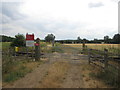
Photos of HG5 8TH


Area Information
HG5 8TH is a small residential postcode area in England, home to 2,016 people spread across 38 residents per square kilometre. This compact cluster of homes is characterised by a mature population, with a median age of 47 and most residents falling within the 30-64 age range. The area is predominantly owner-occupied, with 74% of homes owned by their occupants, suggesting a stable, long-term community. While the postcode covers a limited geographical footprint, it is well-connected to nearby towns and amenities. Daily life here is likely shaped by a mix of local shops, rail links, and schools, making it practical for families and professionals. The low population density means a quieter, more spread-out living environment compared to larger urban areas. For those seeking a balance between residential comfort and accessibility, HG5 8TH offers a snapshot of a traditional English village setting, with homes primarily in detached or semi-detached styles. The area’s proximity to rail stations and retail hubs suggests it is positioned to serve both local needs and broader regional travel.
- Area Type
- Postcode
- Area Size
- Not available
- Population
- 2016
- Population Density
- 38 people/km²
The property market in HG5 8TH is dominated by owner-occupied homes, with 74% of properties owned by their residents. This high ownership rate suggests a stable market with fewer rental properties, which may appeal to buyers seeking long-term investment or family homes. The accommodation type is primarily houses, indicating a focus on traditional housing stock rather than apartments or flats. Given the small size of the postcode area, the housing stock is likely limited, which could mean fewer options for buyers but potentially more established properties. The high home ownership rate also implies that the area may not be a hotspot for short-term rental or speculative investment. For buyers, this suggests a market where properties are likely to be in good condition, with a lower risk of rapid price fluctuations. The presence of nearby rail stations and retail amenities may further enhance the area’s appeal as a family-friendly location with practical connectivity.
House Prices in HG5 8TH
No properties found in this postcode.
Energy Efficiency in HG5 8TH
Residents of HG5 8TH have access to nearby retail amenities, including Aldi, M&S Knaresborough, and Asda Wetherby, which are within practical reach. These stores provide a range of shopping options, from everyday essentials to larger retail chains. The area’s rail stations—Cattal, Knaresborough, and Hammerton—offer direct links to nearby towns, enhancing convenience for both leisure and commuting. While the data does not mention parks or leisure facilities, the presence of retail and rail infrastructure suggests a lifestyle that prioritises practicality and accessibility. The small postcode area likely means a close-knit community with local services catering to daily needs. For those who enjoy a mix of retail and transport options, HG5 8TH offers a balance of convenience and connectivity without the density of larger urban centres.
Amenities
Schools
HG5 8TH is served by two primary schools: Kirk Hammerton Church of England Primary School, which holds an Ofsted rating of 'good', and Kirk Deighton CofE School. Both institutions cater to younger children, providing a local option for families with primary-aged children. The presence of two primary schools suggests a focus on early education within the area, reducing the need for long commutes to secondary schools. The 'good' Ofsted rating at Kirk Hammerton indicates a school that meets quality standards, though specific details on curriculum or performance are not provided. For parents, the availability of two primary schools offers choice and convenience, though the absence of secondary schools means students will need to travel to nearby towns for further education. The mix of school types is limited to primary education, which is typical for small rural postcodes.
| Rank | School | Type | Entry gender | Ages |
|---|
Explore more schools in this area
Go to Schools tabDemographics
The community in HG5 8TH is predominantly composed of adults aged 30-64, with a median age of 47. This suggests a population skewed towards middle-aged individuals, likely including families and professionals. Home ownership is high, at 74%, indicating a strong presence of long-term residents rather than renters. The accommodation type is primarily houses, which aligns with the demographic profile of a settled, family-oriented population. The predominant ethnic group is White, though specific data on diversity or deprivation is not provided. The age distribution implies a community with established careers and children likely attending local primary schools. With 74% of homes owned by residents, the area may have a lower turnover rate compared to more transient regions. The absence of specific data on deprivation means the quality of life cannot be assessed in that regard, but the stability of ownership and age profile suggests a relatively consistent standard of living.
Household Size
Accommodation Type
Tenure
Ethnic Group
Religion
Household Composition
Age
Household Deprivation
NS-SEC
Explore more demographic insights in this area
Go to Demographics tabPlanning
Planning Constraints
- Flood RiskPremium
- Ramsar Wetland SitesPremium
- Area of Outstanding Natural BeautyPremium
- Protected Nature ReservePremium
- Protected WoodlandPremium