Area Overview for HG5 8EL
Photos of HG5 8EL
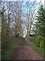
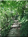
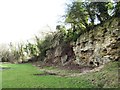

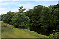
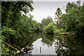
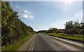

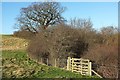
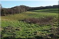
85 photos from this area
Area Information
Key information about the HG5 8EL including its size, population, and administrative classification.
- Area Type
- Postcode
- Area Size
- 3.9 hectares
- Population
- 1615
- Population Density
- 898 people/km²
House Prices in HG5 8EL
36
Properties
£354,401
Average Sold Price
£77,900
Lowest Price
£622,000
Highest Price
Showing 36 properties
| Address | Type | Beds | Baths | Last Sale Price | Last Sale Date | |
|---|---|---|---|---|---|---|
| 56 Aspin Oval, Knaresborough, HG5 8EL | Bungalow | 4 | 2 | £530,500 | May 2025 | |
| Crag Top, 64 Aspin Oval, Knaresborough, HG5 8EL | Bungalow | 2 | 1 | £505,000 | Mar 2025 | |
| 46 Aspin Oval, Knaresborough, HG5 8EL | Detached | 3 | 2 | £425,000 | Apr 2024 | |
| 32 Aspin Oval, Knaresborough, HG5 8EL | Retail | 4 | 3 | £622,000 | Jun 2022 | |
| 45 Aspin Oval, Knaresborough, HG5 8EL | Bungalow | - | - | £300,000 | Apr 2021 | |
| 22 Aspin Oval, Knaresborough, HG5 8EL | house | - | - | £378,000 | Mar 2021 | |
| 26 Aspin Oval, Knaresborough, HG5 8EL | house | - | - | £410,000 | Feb 2021 | |
| 49 Aspin Oval, Knaresborough, HG5 8EL | Detached | 3 | 2 | £460,250 | Dec 2020 | |
| 68 Aspin Oval, Knaresborough, HG5 8EL | Semi-detached | 3 | - | £295,000 | Dec 2019 | |
| 28 Aspin Oval, Knaresborough, HG5 8EL | Semi-detached | 4 | 2 | £515,000 | Sep 2019 |
Page 1 of 4
Energy Efficiency in HG5 8EL
Amenities
Schools
| Rank | School | Type | Entry gender | Ages |
|---|
Explore more schools in this area
Go to Schools tabDemographics
Household Size
Two person
most common
Accommodation Type
Houses
most common
Tenure
91
majority
Ethnic Group
White
most common
Religion
N/A
most common
Household Composition
N/A
most common
Age
47
median
Adults (30-64 years)
most common
Household Deprivation
N/A
with no deprivation
NS-SEC
47
in Lower managerial occupations
Explore more demographic insights in this area
Go to Demographics tabPlanning
Planning Constraints
- Flood RiskPremium
- Ramsar Wetland SitesPremium
- Area of Outstanding Natural BeautyPremium
- Protected Nature ReservePremium
- Protected WoodlandPremium