Area Overview for HG4 4LH
Photos of HG4 4LH
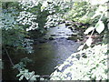
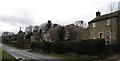
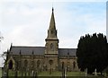
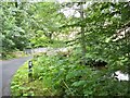
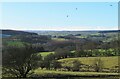
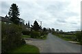
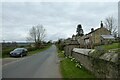
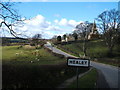
43 photos from this area
Area Information
Key information about the HG4 4LH including its size, population, and administrative classification.
- Area Type
- Postcode
- Area Size
- 88.2 hectares
- Population
- 1130
- Population Density
- 10 people/km²
House Prices in HG4 4LH
24
Properties
£477,520
Average Sold Price
£222,500
Lowest Price
£725,000
Highest Price
Showing 24 properties
| Address | Type | Beds | Baths | Last Sale Price | Last Sale Date | |
|---|---|---|---|---|---|---|
| Moor View, Kell Bank, Healey, HG4 4LH | house | - | - | £375,000 | Sep 2024 | |
| Fair View, Healey To Leighton Bridge, Healey, HG4 4LH | house | - | - | £725,000 | Jun 2024 | |
| Burnside House, Kell Bank, Healey, HG4 4LH | house | - | - | £550,000 | Sep 2023 | |
| Sunnyside, Kell Bank, Healey, HG4 4LH | house | - | - | £460,000 | Aug 2023 | |
| Springwood Farm, Kell Bank, Healey, HG4 4LH | house | - | - | £693,000 | May 2021 | |
| The Mill House, Healey To Leighton Bridge, Healey, HG4 4LH | house | - | - | £610,600 | Sep 2017 | |
| Ilton House, Kell Bank, Healey, HG4 4LH | Detached | 4 | 2 | £425,000 | Apr 2014 | |
| Briony Cottage, Kell Bank, Healey, HG4 4LH | Semi-detached | - | - | £222,500 | Aug 2006 | |
| Springwood House, Kell Bank, Healey, HG4 4LH | Detached | - | - | £379,000 | Oct 2005 | |
| Black Horse House, Kell Bank, Healey, HG4 4LH | Detached | - | - | £335,100 | Dec 2002 |
Page 1 of 3
Energy Efficiency in HG4 4LH
Amenities
Schools
| Rank | School | Type | Entry gender | Ages |
|---|
Explore more schools in this area
Go to Schools tabDemographics
Household Size
Two person
most common
Accommodation Type
Houses
most common
Tenure
70
majority
Ethnic Group
White
most common
Religion
N/A
most common
Household Composition
N/A
most common
Age
47
median
Adults (30-64 years)
most common
Household Deprivation
N/A
with no deprivation
NS-SEC
40
in Lower managerial occupations
Explore more demographic insights in this area
Go to Demographics tabPlanning
Planning Constraints
- Flood RiskPremium
- Ramsar Wetland SitesPremium
- Area of Outstanding Natural BeautyPremium
- Protected Nature ReservePremium
- Protected WoodlandPremium