Area Overview for HG4 3XS
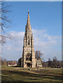
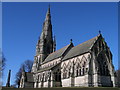
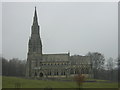
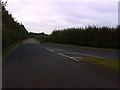
Photos of HG4 3XS


Area Information
HG4 3XS is a small, tightly knit residential postcode in England with a population of 1464, spread across a low-density area of 30 people per square kilometre. This suggests spacious living conditions with a quiet, suburban character. The area is predominantly occupied by adults aged 30–64, with a median age of 47, indicating a mature, stable community. Most residents own their homes, with 71% of properties in private ownership, and housing is largely composed of houses rather than flats. Daily life here is shaped by proximity to essential services, including five retail outlets such as Morrisons and The Southern Co-operative, which cater to local needs. The area’s safety profile is strong, with a crime risk score of 97, reflecting below-average crime rates. Families may find value in the nearby schools, though the mix of primary and special educational institutions suggests a focus on tailored learning environments. Living in HG4 3XS offers a blend of tranquillity, practical amenities, and a low-risk environment, making it appealing for those seeking a settled lifestyle.
- Area Type
- Postcode
- Area Size
- Not available
- Population
- 1464
- Population Density
- 30 people/km²
The property market in HG4 3XS is dominated by owner-occupied homes, with 71% of properties in private hands. This contrasts with areas where rental markets are more prevalent, suggesting a community of long-term residents rather than a transient population. The accommodation type is exclusively houses, which is unusual in many modern developments where flats or apartments are common. This indicates a traditional, possibly older housing stock with larger properties, which may appeal to families or individuals seeking more space. However, the small population of 1464 and low density mean the housing stock is limited, making the area’s property market niche. Buyers should consider the scarcity of available properties and the potential for limited scope for new development. For those seeking a house in a quiet, low-density area with a strong sense of community, HG4 3XS may offer a unique opportunity.
House Prices in HG4 3XS
No properties found in this postcode.
Energy Efficiency in HG4 3XS
The lifestyle in HG4 3XS is shaped by its proximity to practical amenities, including five retail outlets such as Morrisons Daily, Morrisons Ripon, and The Southern Co-operative Co. These stores provide access to groceries, household goods, and other essentials, reducing the need for longer trips to larger centres. The area’s low population density and focus on houses suggest a quieter, more private living environment, though specific details about parks, leisure facilities, or dining options are not provided. The presence of multiple retail venues indicates a functional, community-oriented approach to shopping, with local businesses likely playing a role in daily life. For residents valuing convenience and a balance between privacy and accessibility, HG4 3XS offers a straightforward, no-frills lifestyle.
Amenities
Schools
Residents of HG4 3XS have access to a range of educational institutions, including North Stainley Church of England Primary School, which serves younger children. Two special schools are also nearby: Spring Hill School and Cambian Spring Hill, the latter of which holds a ‘good’ Ofsted rating. This mix of school types suggests the area caters to both mainstream and specialist educational needs. The presence of special schools may indicate a higher proportion of families with children requiring tailored support, though the primary school is the main option for general education. For parents seeking a broad range of schooling options, the combination of primary and special schools provides flexibility. However, the absence of secondary schools in the data means families may need to look further afield for older children’s education.
| Rank | School | Type | Entry gender | Ages |
|---|
Explore more schools in this area
Go to Schools tabDemographics
The community in HG4 3XS is characterised by a median age of 47, with the majority of residents falling within the 30–64 age range. This suggests a population that is largely in middle age or beyond, with fewer younger families or retirees compared to other areas. Home ownership is high at 71%, indicating a preference for long-term residency rather than rental properties. The accommodation type is predominantly houses, which aligns with the area’s low population density. The predominant ethnic group is White, though no specific data on diversity or deprivation levels is provided. The low population density of 30 people per square kilometre implies spacious, possibly rural or semi-rural living conditions. For quality of life, this demographic profile suggests a community focused on stability and established living, with fewer transient residents. The absence of detailed diversity statistics means the area’s social composition remains largely homogenous based on the available data.
Household Size
Accommodation Type
Tenure
Ethnic Group
Religion
Household Composition
Age
Household Deprivation
NS-SEC
Explore more demographic insights in this area
Go to Demographics tabPlanning
Planning Constraints
- Flood RiskPremium
- Ramsar Wetland SitesPremium
- Area of Outstanding Natural BeautyPremium
- Protected Nature ReservePremium
- Protected WoodlandPremium