Area Overview for HG4 3BT
Photos of HG4 3BT
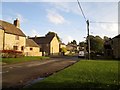
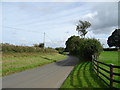
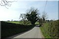
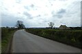

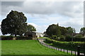
12 photos from this area
Area Information
Key information about the HG4 3BT including its size, population, and administrative classification.
- Area Type
- Postcode
- Area Size
- 11.1 hectares
- Population
- 1130
- Population Density
- 10 people/km²
House Prices in HG4 3BT
30
Properties
£294,324
Average Sold Price
£50,000
Lowest Price
£500,000
Highest Price
Showing 30 properties
| Address | Type | Beds | Baths | Last Sale Price | Last Sale Date | |
|---|---|---|---|---|---|---|
| 1, Primrose Cottages, Grewelthorpe Village, Grewelthorpe, HG4 3BT | Terraced | 3 | 1 | £275,000 | Oct 2023 | |
| The Old Post Office, Grewelthorpe Village, Grewelthorpe, HG4 3BT | house | 3 | 1 | £452,500 | Apr 2022 | |
| Ivy House, Grewelthorpe Village, Grewelthorpe, HG4 3BT | house | - | - | £395,000 | May 2021 | |
| Nappa House, Grewelthorpe Village, Grewelthorpe, HG4 3BT | house | - | - | £400,000 | Jul 2020 | |
| Rose Cottage, Grewelthorpe Village, Grewelthorpe, HG4 3BT | house | - | - | £325,000 | May 2019 | |
| Lakeside, Grewelthorpe Village, Grewelthorpe, HG4 3BT | house | - | - | £494,000 | Jul 2016 | |
| 2, Primrose Cottages, Grewelthorpe Village, Grewelthorpe, HG4 3BT | Semi-detached | 3 | - | £352,000 | May 2013 | |
| Mallard Cottage, Willow Garth Track, Grewelthorpe, HG4 3BT | house | 4 | - | £300,000 | Aug 2011 | |
| Spring Cottage, Grewelthorpe Village, Grewelthorpe, HG4 3BT | house | - | - | £100,000 | Dec 2009 | |
| Holly Paddock, Grewelthorpe Village, Grewelthorpe, HG4 3BT | Detached | - | - | £280,000 | Apr 2009 |
Page 1 of 3
Energy Efficiency in HG4 3BT
Amenities
Schools
| Rank | School | Type | Entry gender | Ages |
|---|
Explore more schools in this area
Go to Schools tabDemographics
Household Size
Two person
most common
Accommodation Type
Houses
most common
Tenure
70
majority
Ethnic Group
White
most common
Religion
N/A
most common
Household Composition
N/A
most common
Age
47
median
Adults (30-64 years)
most common
Household Deprivation
N/A
with no deprivation
NS-SEC
40
in Lower managerial occupations
Explore more demographic insights in this area
Go to Demographics tabPlanning
Planning Constraints
- Flood RiskPremium
- Ramsar Wetland SitesPremium
- Area of Outstanding Natural BeautyPremium
- Protected Nature ReservePremium
- Protected WoodlandPremium