Area Overview for HG4 2PX
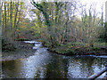
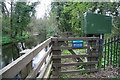
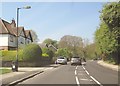
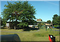
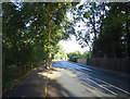
Photos of HG4 2PX

Area Information
HG4 2PX is a small, tightly knit residential area in England, covering 4,581 square metres and home to 1,611 residents. With a population density of 1,314 people per square kilometre, it is a compact community where daily life is shaped by proximity to local amenities and schools. The area’s demographic profile suggests a mature population, with a median age of 47 and a strong presence of adults aged 30–64. This reflects a stable, family-oriented environment, supported by a high rate of home ownership (62%) and a predominance of houses over flats or apartments. The postcode’s proximity to primary schools, including Holy Trinity CofE Infant School and St Wilfrid’s Catholic Primary School, positions it as a family-friendly location. However, the area’s small size means residents must balance convenience with limited expansion, and the critical flood risk assessment adds a layer of environmental consideration for potential buyers. Despite this, the low crime risk and access to nearby retail and transport options, such as RAF Dishforth, suggest a practical, if modest, lifestyle.
- Area Type
- Postcode
- Area Size
- 4581 m²
- Population
- 1611
- Population Density
- 1314 people/km²
The property market in HG4 2PX is characterised by a high rate of home ownership (62%) and a predominance of houses. This suggests the area is not a rental hotspot but rather a place where many residents own their homes, likely as long-term investments. The small size of the postcode area means the housing stock is limited, which could make the market competitive for buyers. The focus on houses rather than flats or apartments indicates a preference for family homes, aligning with the community’s demographic profile of adults aged 30–64. For prospective buyers, this implies that properties may be in high demand, particularly for those seeking a stable, established neighbourhood. However, the limited size of the area means that the immediate surroundings are crucial for accessing additional housing options. Buyers should consider the area’s constraints and the importance of proximity to amenities when evaluating properties.
House Prices in HG4 2PX
Showing 8 properties
| Address | Type | Beds | Baths | Last Sale Price | Last Sale Date | |
|---|---|---|---|---|---|---|
| 5 Skellbank Close, Ripon, HG4 2PX | Detached | 3 | 1 | £284,000 | May 2020 | |
| 1 Skellbank Close, Ripon, HG4 2PX | house | - | - | £281,000 | Apr 2017 | |
| 10 Skellbank Close, Ripon, HG4 2PX | house | 3 | - | £242,500 | Apr 2012 | |
| 8 Skellbank Close, Ripon, HG4 2PX | Detached | - | - | £142,000 | Oct 1998 | |
| 3 Skellbank Close, Ripon, HG4 2PX | Semi-detached | - | - | £73,000 | Oct 1998 | |
| 6 Skellbank Close, Ripon, HG4 2PX | Semi-detached | - | - | - | - | |
| 4 Skellbank Close, Ripon, HG4 2PX | house | - | - | - | - | |
| 2 Skellbank Close, Ripon, HG4 2PX | Bungalow | - | - | - | - |
Energy Efficiency in HG4 2PX
Residents of HG4 2PX have access to a range of local amenities that shape daily life. The nearby retail options include Booths Ripon, Sainsburys Ripon, and Morrisons Daily Ripon 64, providing essential shopping and grocery needs within easy reach. The presence of RAF Dishforth adds a unique element to the area, potentially offering employment opportunities or facilities for military personnel and their families. While the data does not detail parks or leisure facilities, the compact nature of the postcode suggests that residents may rely on nearby towns for more extensive recreational options. The combination of retail outlets and the RAF creates a practical, if limited, lifestyle, where convenience is prioritised over expansive leisure choices. This makes HG4 2PX suitable for those valuing accessibility and proximity to services, though larger-scale amenities may require travel beyond the immediate area.
Amenities
Schools
HG4 2PX is served by a cluster of primary schools, including Holy Trinity CofE Infant School, St Wilfrid’s Catholic Primary School, and Holy Trinity Church of England Junior School. These institutions cater to young children, with a mix of traditional state schools and academies. The Holy Trinity Church of England Junior School has an Ofsted rating of ‘satisfactory’, while others are either primary or academy-run but lack specific ratings in the data. The presence of multiple schools within close proximity offers families flexibility in choosing education options, though the types available are primarily focused on early years and primary education. For parents, this suggests a well-established local education network, though secondary school options are not detailed in the data. The concentration of schools supports the area’s family-friendly reputation but may limit access to specialist provision or higher education facilities nearby.
| Rank | School | Type | Entry gender | Ages |
|---|
Explore more schools in this area
Go to Schools tabDemographics
The community in HG4 2PX is defined by its demographic makeup. With a median age of 47, the area is predominantly populated by adults aged 30–64, indicating a mature, stable population. Home ownership stands at 62%, suggesting a strong presence of long-term residents rather than a transient rental market. The accommodation type is largely houses, which aligns with the area’s residential character. The predominant ethnic group is White, reflecting a lack of ethnic diversity in the population. The high population density of 1,314 people per square kilometre, combined with the small area size, means the community is closely knit but also limited in spatial growth. This density may influence local services and infrastructure, though the data does not indicate deprivation levels. For residents, the demographic profile suggests a focus on family stability and long-term living, with fewer young families or students compared to other areas.
Household Size
Accommodation Type
Tenure
Ethnic Group
Religion
Household Composition
Age
Household Deprivation
NS-SEC
Explore more demographic insights in this area
Go to Demographics tabPlanning
Planning Constraints
- Flood RiskPremium
- Ramsar Wetland SitesPremium
- Area of Outstanding Natural BeautyPremium
- Protected Nature ReservePremium
- Protected WoodlandPremium