Area Overview for HG4 2PR
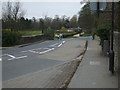
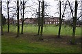
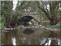
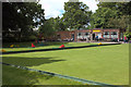
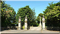
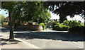
Photos of HG4 2PR


Area Information
HG4 2PR is a small, tightly knit residential postcode area in England, covering just 3,607 square metres and home to 1,611 residents. Its compact size means it feels like a close-knit community, with a population density of 1,314 people per square kilometre. The area’s character is defined by its focus on family living, with a median age of 47 and a strong presence of adults aged 30–64. Daily life here is shaped by proximity to essential services, including five retail outlets like Booths Ripon and Sainsburys Ripon, and a nearby RAF Dishforth airfield. While the area lacks major urban infrastructure, its low crime risk and absence of environmental constraints make it appealing for those seeking a quieter, safer lifestyle. Schools are a key feature, with multiple primary schools and academies catering to local families. The mix of homes, predominantly owner-occupied houses, suggests a stable, long-term resident base. For buyers, HG4 2PR offers a snapshot of rural living with practical access to nearby amenities, though its small size means the immediate surroundings are critical to daily convenience.
- Area Type
- Postcode
- Area Size
- 3607 m²
- Population
- 1611
- Population Density
- 1314 people/km²
The property market in HG4 2PR is dominated by owner-occupied homes, with 62% of residents living in properties they own. This suggests a market where long-term residency is common, and the housing stock is largely composed of houses rather than flats or apartments. The small area size means the available properties are limited, and buyers should consider the immediate surroundings for additional options. The focus on houses indicates a preference for larger, more private living spaces, which may appeal to families or individuals seeking space. However, the lack of rental data means it is unclear whether the area also attracts tenants. For buyers, the high home ownership rate and stable demographics suggest a reliable market, though the small size of the postcode means proximity to nearby villages or towns is essential for access to broader amenities.
House Prices in HG4 2PR
No properties found in this postcode.
Energy Efficiency in HG4 2PR
The lifestyle in HG4 2PR is shaped by its proximity to retail outlets such as Booths Ripon, Sainsburys Ripon, and Spar, which provide essential shopping and daily necessities. The presence of these stores suggests a practical, community-focused approach to retail, though the area lacks larger supermarkets or specialist shops. The nearby RAF Dishforth airfield adds a unique character but does not serve as a commercial transport hub. For leisure, the area’s small size means residents may need to travel to nearby towns for parks or recreational facilities. However, the low crime risk and absence of environmental constraints contribute to a sense of safety and stability. The mix of schools, retail, and military infrastructure creates a distinct local identity, blending practicality with a quiet, secure environment.
Amenities
Schools
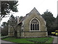
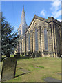
HG4 2PR is served by several primary schools, including Holy Trinity CofE Infant School, St Wilfrid’s Catholic Primary School, and Holy Trinity Church of England Infant and Nursery. These schools cater to younger children, with a mix of church-affiliated and academy-run institutions. The Holy Trinity Church of England Junior School has an Ofsted rating of satisfactory, while others are listed as academies without specified ratings. This variety provides families with options, though the absence of secondary schools means students may need to travel to nearby areas for higher education. The concentration of primary schools reflects the area’s family-oriented character, supporting local children’s education. However, prospective buyers should consider the need for transport to secondary schools, as none are explicitly mentioned in the data.
| Rank | School | Type | Entry gender | Ages |
|---|
Explore more schools in this area
Go to Schools tabDemographics
The community in HG4 2PR is predominantly composed of adults aged 30–64, with a median age of 47. This suggests a mature population, likely with established careers and families. Home ownership is high at 62%, indicating a stable housing market where most residents live in their own homes. The accommodation type is primarily houses, which aligns with the area’s residential character. The predominant ethnic group is White, reflecting a homogeneous demographic profile. While no specific data on deprivation is provided, the low crime risk and absence of environmental constraints suggest a quality of life that is generally secure. The population density of 1,314 people per square kilometre implies a moderately compact living environment, balancing private space with community interaction. For families, this demographic profile means a mix of older residents and likely school-age children, supported by the nearby primary schools. The area’s stability and low risk factors make it suitable for those prioritising safety and long-term residency.
Household Size
Accommodation Type
Tenure
Ethnic Group
Religion
Household Composition
Age
Household Deprivation
NS-SEC
Explore more demographic insights in this area
Go to Demographics tabPlanning
Planning Constraints
- Flood RiskPremium
- Ramsar Wetland SitesPremium
- Area of Outstanding Natural BeautyPremium
- Protected Nature ReservePremium
- Protected WoodlandPremium