Area Overview for HG4 2BY
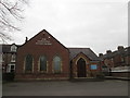
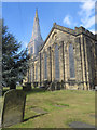
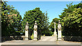
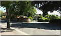
Photos of HG4 2BY


Area Information
HG4 2BY is a compact residential postcode area in England, covering just 1.0 hectare and home to 1,611 residents. Its high population density of 1,314 people per square kilometre reflects a tightly knit community, likely centred around local amenities and schools. The area’s small size suggests a focused, perhaps village-like character, with homes clustered closely together. Daily life here is shaped by proximity to essential services, including multiple primary schools and nearby retail outlets. The demographic profile—primarily adults aged 30–64, with a median age of 47—hints at a stable, family-oriented population. While the area lacks sprawling green spaces or major infrastructure, its low crime risk and flood safety score make it appealing for those prioritising security. Residents benefit from a practical balance of convenience and safety, though the limited area size means the community is small and intimate. For buyers, HG4 2BY offers a snapshot of a mature, settled neighbourhood where local schools and shops are within easy reach, and environmental risks are minimal.
- Area Type
- Postcode
- Area Size
- 1.0 hectares
- Population
- 1611
- Population Density
- 1314 people/km²
The property market in HG4 2BY is dominated by owner-occupied homes, with 62% of residents living in houses rather than rented accommodation. This suggests a stable, long-term resident base with little turnover. The small area size means the housing stock is limited, likely consisting of traditional family homes rather than newer developments. Buyers should consider that the area’s compact nature may restrict availability, particularly for larger properties. The high home ownership rate indicates strong local demand, though the lack of flats or apartments suggests it is not a rental hotspot. For those seeking a home here, the focus is on established housing with proximity to schools and amenities. However, the limited size of HG4 2BY means buyers must prioritise proximity to nearby services, as expansion is unlikely.
House Prices in HG4 2BY
Showing 2 properties
| Address | Type | Beds | Baths | Last Sale Price | Last Sale Date | |
|---|---|---|---|---|---|---|
| Burnham House, 12 Park Street, Ripon, HG4 2BY | Detached | 5 | 3 | £870,000 | Mar 2015 | |
| Burnham Close Cottage, 12A Park Street, Ripon, HG4 2BY | Detached | 3 | - | £302,500 | Sep 2013 |
Energy Efficiency in HG4 2BY
Residents of HG4 2BY have access to a range of nearby amenities, including five retail outlets such as Booths Ripon, Sainsburys Ripon, and Spar, ensuring everyday shopping needs are met. The presence of RAF Dishforth nearby adds a unique element to the area’s character, though it is unlikely to influence daily life for most residents. The compact nature of the postcode means amenities are within practical reach, supporting a convenient lifestyle. While the area lacks large parks or leisure facilities, its proximity to schools and shops suggests a focus on practicality over expansive recreational spaces. The mix of retail options and the nearby airport highlight a balance between community needs and regional infrastructure, offering a lifestyle that prioritises accessibility and essential services.
Amenities
Schools
HG4 2BY is served by several primary schools, including Holy Trinity CofE Junior School, Holy Trinity CofE Infant School, and St Wilfrid’s Catholic Primary School. Two of these are academies: Holy Trinity Church of England Junior School, which has an Ofsted rating of satisfactory, and Holy Trinity Church of England Infant and Nursery. The mix of church-affiliated and state-run schools offers families a range of educational options, though the presence of multiple primary schools suggests a focus on early education. The area’s schools are likely a key draw for families, with the academies potentially offering specialised curricula or resources. However, no secondary schools are listed, meaning residents may need to travel further for higher education. The proximity of multiple schools indicates a community prioritising family needs, with education as a central factor in the area’s appeal.
| Rank | School | Type | Entry gender | Ages |
|---|
Explore more schools in this area
Go to Schools tabDemographics
The population of HG4 2BY is predominantly adults aged 30–64, with a median age of 47, suggesting a community of established professionals and families. Home ownership is strong, with 62% of residents owning their homes, indicating a stable housing market. The area is characterised by houses rather than flats, aligning with its small, residential nature. The predominant ethnic group is White, which shapes the cultural and social fabric of the area. While no specific data on deprivation is provided, the high home ownership rate and low crime score imply a relatively affluent and secure environment. The age profile suggests a balance between working-age individuals and older residents, with fewer young families or retirees compared to other areas. This demographic mix may influence local amenities and services, which appear tailored to a mature, settled population.
Household Size
Accommodation Type
Tenure
Ethnic Group
Religion
Household Composition
Age
Household Deprivation
NS-SEC
Explore more demographic insights in this area
Go to Demographics tabPlanning
Planning Constraints
- Flood RiskPremium
- Ramsar Wetland SitesPremium
- Area of Outstanding Natural BeautyPremium
- Protected Nature ReservePremium
- Protected WoodlandPremium