Area Overview for HG4 1UL
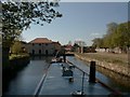
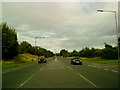
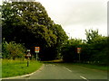
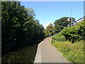
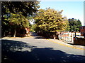
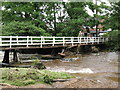
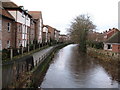
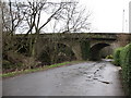
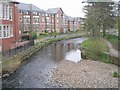
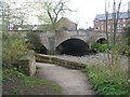
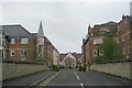
Photos of HG4 1UL

Area Information
HG4 1UL is a compact residential postcode area in England, covering 7,683 square metres and home to 1,319 residents. Its high population density of 171,683 people per square kilometre reflects a tightly knit community, though the area’s small size means it is a focused cluster of homes rather than a sprawling suburb. Living here offers proximity to essential services, with five retail outlets within reach, including Morrisons Daily Ripon 64 and Morrisons Ripon, ensuring daily needs are met locally. The area’s character is shaped by its demographics: residents are predominantly adults aged 30–64, with a median age of 47. This suggests a mature, stable community, likely with established families and professionals. While the area lacks major natural or cultural landmarks, its practical amenities and low crime risk make it a viable choice for those prioritising safety and convenience. However, the broadband score of 27 indicates limited internet infrastructure, which may impact remote work or digital lifestyles. For buyers seeking a quiet, low-maintenance neighbourhood with direct access to retail and transport links, HG4 1UL offers a straightforward, no-frills option.
- Area Type
- Postcode
- Area Size
- 7683 m²
- Population
- 1319
- Population Density
- 6655 people/km²
The property market in HG4 1UL is characterised by a 61% home ownership rate, indicating that the majority of properties are owner-occupied rather than rented out. This suggests a stable market with residents who are likely to remain in the area long-term. The accommodation type is predominantly houses, which is unusual for a small postcode area but may reflect a focus on single-family homes. This contrasts with areas where flats or apartments dominate, and it could mean that HG4 1UL appeals to buyers seeking space and privacy. However, the high population density of 171,683 people per square kilometre implies that properties are closely packed, which may limit availability of larger homes. Buyers should consider that the small size of the area means the housing stock is limited, and competition for properties could be intense. The market is likely to cater to those prioritising ownership over rental flexibility, with a focus on traditional housing rather than modern developments.
House Prices in HG4 1UL
Showing 15 properties
| Address | Type | Beds | Baths | Last Sale Price | Last Sale Date | |
|---|---|---|---|---|---|---|
| 1 Gallows Hill Park, Ripon, HG4 1UL | Flat | - | - | - | - | |
| 3 Gallows Hill Park, Ripon, HG4 1UL | Flat | - | - | - | - | |
| 5 Gallows Hill Park, Ripon, HG4 1UL | Flat | - | - | - | - | |
| 7 Gallows Hill Park, Ripon, HG4 1UL | Flat | - | - | - | - | |
| 2 Gallows Hill Park, Ripon, HG4 1UL | Flat | - | - | - | - | |
| 8 Gallows Hill Park, Ripon, HG4 1UL | Flat | - | - | - | - | |
| 4 Gallows Hill Park, Ripon, HG4 1UL | Flat | - | - | - | - | |
| 6 Gallows Hill Park, Ripon, HG4 1UL | Flat | - | - | - | - | |
| 12 Gallows Hill Park, Ripon, HG4 1UL | Terraced | - | - | - | - | |
| 14 Gallows Hill Park, Ripon, HG4 1UL | house | - | - | - | - |
Energy Efficiency in HG4 1UL
Residents of HG4 1UL have access to five retail outlets within practical reach, including Morrisons Daily Ripon 64, Morrisons Ripon, and Morrisons Daily. These stores offer a range of goods, from groceries to everyday essentials, supporting a convenient shopping experience without the need to travel far. The presence of RAF Dishforth airport adds a unique dimension to the area, providing direct access to air travel for residents. While the area lacks dedicated parks or leisure facilities, the compact layout ensures that essential services are within walking or short driving distance. The retail options contribute to a practical, no-frills lifestyle, ideal for those prioritising accessibility over expansive recreational spaces. However, the absence of detailed information on dining or entertainment venues means the area’s social scene remains underdefined. For buyers, the key advantage is the proximity to retail and transport, though the limited amenities may require reliance on nearby towns for more diverse leisure options.
Amenities
Schools
| Rank | School | Type | Entry gender | Ages |
|---|
Explore more schools in this area
Go to Schools tabDemographics
The population of HG4 1UL is 1,319, with a median age of 47, indicating a community skewed towards middle-aged adults. The most common age range is 30–64 years, suggesting a mix of working professionals and families with children. Home ownership sits at 61%, meaning nearly two-thirds of residents live in properties they own, while the remaining 39% are likely renters. The predominant accommodation type is houses, which aligns with the area’s low density and residential focus. The ethnic composition is predominantly White, though no specific data on diversity or deprivation is provided. This demographic profile implies a stable, long-term resident base with established social networks. The absence of detailed diversity metrics means the community’s cultural makeup remains unspecified, but the age range and home ownership figures suggest a balanced mix of career-focused individuals and families. For buyers, this translates to a market where properties are likely to be occupied by long-term residents, potentially offering a sense of continuity and community cohesion.
Household Size
Accommodation Type
Tenure
Ethnic Group
Religion
Household Composition
Age
Household Deprivation
NS-SEC
Explore more demographic insights in this area
Go to Demographics tabPlanning
Planning Constraints
- Flood RiskPremium
- Ramsar Wetland SitesPremium
- Area of Outstanding Natural BeautyPremium
- Protected Nature ReservePremium
- Protected WoodlandPremium