Area Overview for HG4 1SN
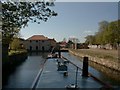
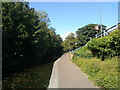
Photos of HG4 1SN


Area Information
HG4 1SN is a small, densely populated residential cluster in England, covering just 2.0 hectares and home to 1,784 residents. Its compact size means the area is tightly knit, with a high population density of 90,049 people per square kilometre. This makes it a close-knit community, though the limited space may mean residents rely on nearby areas for additional amenities. The area’s character is shaped by its mix of older and newer housing stock, with a focus on single-family homes. Given its small footprint, HG4 1SN is not a sprawling suburb but a concentrated cluster of properties, often with shared local services. Daily life here is defined by proximity to retail and transport hubs, though the area’s size means it is best suited for those prioritising convenience over expansive living space. The presence of nearby supermarkets and an airport suggests a balance between local needs and regional connectivity. For buyers, HG4 1SN offers a compact, established environment, though its limited size may require considering adjacent areas for more space.
- Area Type
- Postcode
- Area Size
- 2.0 hectares
- Population
- 1784
- Population Density
- 5129 people/km²
The property market in HG4 1SN is characterised by a 49% home ownership rate, indicating that just under half of properties are owner-occupied, with the remainder likely rented out. The accommodation type is predominantly houses, which suggests a focus on single-family homes rather than apartments or flats. This mix may appeal to buyers seeking traditional housing stock, though the area’s small size means the available properties are limited. The high population density, combined with the predominance of houses, implies that the housing stock is compact and possibly older, with limited scope for expansion. For buyers, this means the market is likely competitive, with few options within HG4 1SN itself. Prospective buyers may need to look beyond the immediate postcode to find more space or alternative property types, particularly if seeking larger homes or newer builds. The area’s proximity to retail and transport hubs may offset its limitations in housing availability.
House Prices in HG4 1SN
Showing 49 properties
| Address | Type | Beds | Baths | Last Sale Price | Last Sale Date | |
|---|---|---|---|---|---|---|
| Southgate House, 5 South Crescent, Ripon, HG4 1SN | house | - | - | £925,000 | Jan 2025 | |
| Walnut House, South Crescent, Ripon, HG4 1SN | house | - | - | £1,200,000 | Jan 2025 | |
| Furtherdown, South Crescent, Ripon, HG4 1SN | Detached | 4 | 1 | £650,000 | Aug 2020 | |
| Loft House, South Crescent, Ripon, HG4 1SN | Detached | 3 | 2 | £232,000 | Jan 2018 | |
| 2A South Crescent, Ripon, HG4 1SN | Maisonette | - | - | £178,000 | Apr 2017 | |
| The Conifers, South Crescent, Ripon, HG4 1SN | Detached | 4 | 3 | £475,000 | Jan 2013 | |
| Larkspur, South Crescent, Ripon, HG4 1SN | house | - | - | £249,950 | Jan 2013 | |
| Brentwood, South Crescent, Ripon, HG4 1SN | Land | - | - | £450,000 | Nov 2012 | |
| Skell Lodge Residential Home, South Crescent, Ripon, HG4 1SN | hospital_care_home | 21 | 7 | - | - | |
| Apartment B, Whitcliffe Cottage, South Crescent, Ripon, HG4 1SN | Flat | - | - | - | - |
Energy Efficiency in HG4 1SN
Living in HG4 1SN offers access to essential retail and services within practical reach. The area is within walking or short driving distance of Morrisons Daily Ripon 64, Sainsburys Ripon, and Booths Ripon, providing a range of grocery and convenience shopping options. These stores likely cater to daily needs, from fresh produce to household goods, reducing the need for long trips. The presence of RAF Dishforth nearby adds a unique dimension, offering potential access to military-related services or events, though the extent of civilian amenities linked to the base is unclear. For leisure, the data does not specify parks or recreational spaces, but the area’s small size suggests limited green spaces. The compact nature of HG4 1SN means residents may need to venture slightly further for more extensive leisure options, though the proximity to retail and transport hubs balances this. The area’s character is defined by its practicality, with amenities focused on convenience rather than luxury.
Amenities
Schools
| Rank | School | Type | Entry gender | Ages |
|---|
Explore more schools in this area
Go to Schools tabDemographics
The community in HG4 1SN is predominantly middle-aged, with a median age of 47 and the largest age group being adults aged 30–64. This suggests a stable, mature population, likely with long-term ties to the area. Home ownership rates are 49%, meaning nearly half of residents rent, which may reflect a mix of long-term residents and transient workers. The area’s accommodation is largely composed of houses, rather than flats or apartments, aligning with the demographic profile of older, family-oriented households. The predominant ethnic group is White, though no data on other ethnicities is provided. With a population density over 90,000 per square kilometre, the area is intensely populated, which may influence social dynamics and local services. While the data does not specify deprivation levels, the high density and moderate home ownership suggest a community where shared resources and local amenities are critical to quality of life.
Household Size
Accommodation Type
Tenure
Ethnic Group
Religion
Household Composition
Age
Household Deprivation
NS-SEC
Explore more demographic insights in this area
Go to Demographics tabPlanning
Planning Constraints
- Flood RiskPremium
- Ramsar Wetland SitesPremium
- Area of Outstanding Natural BeautyPremium
- Protected Nature ReservePremium
- Protected WoodlandPremium