Area Overview for HG4 1EJ
Photos of HG4 1EJ


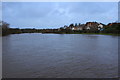

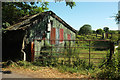
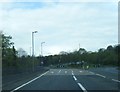
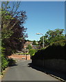


69 photos from this area
Area Information
Key information about the HG4 1EJ including its size, population, and administrative classification.
- Area Type
- Postcode
- Area Size
- 7.2 hectares
- Population
- 1591
- Population Density
- 1100 people/km²
House Prices in HG4 1EJ
46
Properties
£284,256
Average Sold Price
£93,000
Lowest Price
£575,000
Highest Price
Showing 46 properties
| Address | Type | Beds | Baths | Last Sale Price | Last Sale Date | |
|---|---|---|---|---|---|---|
| 28 Kings Mead, Ripon, HG4 1EJ | house | 4 | 3 | £575,000 | Nov 2025 | |
| 35 Kings Mead, Ripon, HG4 1EJ | house | 5 | 3 | £550,000 | Jul 2024 | |
| 49 Kings Mead, Ripon, HG4 1EJ | Bungalow | 3 | 2 | £365,000 | Jan 2024 | |
| 55 Kings Mead, Ripon, HG4 1EJ | Bungalow | 3 | 2 | £455,000 | Dec 2023 | |
| 45 Kings Mead, Ripon, HG4 1EJ | house | 4 | 1 | £485,000 | Oct 2023 | |
| 7 Kings Mead, Ripon, HG4 1EJ | Bungalow | 3 | 2 | £495,000 | Nov 2022 | |
| 5 Kings Mead, Ripon, HG4 1EJ | Bungalow | - | - | £415,000 | Sep 2021 | |
| 29 Kings Mead, Ripon, HG4 1EJ | Bungalow | 3 | 1 | £235,000 | Aug 2020 | |
| 47 Kings Mead, Ripon, HG4 1EJ | house | - | - | £330,000 | Dec 2019 | |
| 4A Kings Mead, Ripon, HG4 1EJ | Semi-detached | 2 | - | £235,000 | Nov 2019 |
Page 1 of 5
Energy Efficiency in HG4 1EJ
Amenities
Schools
| Rank | School | Type | Entry gender | Ages |
|---|
Explore more schools in this area
Go to Schools tabDemographics
Household Size
One person
most common
Accommodation Type
Houses
most common
Tenure
69
majority
Ethnic Group
White
most common
Religion
N/A
most common
Household Composition
N/A
most common
Age
47
median
Adults (30-64 years)
most common
Household Deprivation
N/A
with no deprivation
NS-SEC
40
in Lower managerial occupations
Explore more demographic insights in this area
Go to Demographics tabPlanning
Planning Constraints
- Flood RiskPremium
- Ramsar Wetland SitesPremium
- Area of Outstanding Natural BeautyPremium
- Protected Nature ReservePremium
- Protected WoodlandPremium