Area Overview for HG3 3RU
Photos of HG3 3RU
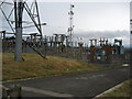


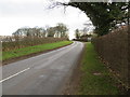

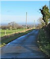
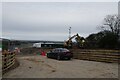
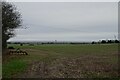
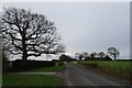
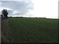
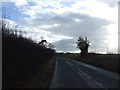
17 photos from this area
Area Information
Key information about the HG3 3RU including its size, population, and administrative classification.
- Area Type
- Postcode
- Area Size
- 85.3 hectares
- Population
- 1463
- Population Density
- 70 people/km²
House Prices in HG3 3RU
52
Properties
£378,889
Average Sold Price
£59,950
Lowest Price
£825,000
Highest Price
Showing 52 properties
| Address | Type | Beds | Baths | Last Sale Price | Last Sale Date | |
|---|---|---|---|---|---|---|
| Essendine Cottage, Station Lane, Burton Leonard, HG3 3RU | Detached | 3 | 1 | £515,000 | Feb 2025 | |
| Abbey Cottage, Station Lane, Burton Leonard, HG3 3RU | Semi-detached | 3 | - | £300,000 | Apr 2024 | |
| Hill Top Farm, Station Lane, Burton Leonard, HG3 3RU | Detached | 4 | 2 | £825,000 | Apr 2023 | |
| Dove House, Station Lane, Burton Leonard, HG3 3RU | Detached | 4 | 2 | £737,021 | Aug 2022 | |
| Rye Croft, Station Lane, Burton Leonard, HG3 3RU | house | - | - | £775,000 | Feb 2022 | |
| Mountville, Station Lane, Burton Leonard, HG3 3RU | house | - | - | £591,375 | Sep 2021 | |
| Luangwa, 5 Station Lane, Burton Leonard, HG3 3RU | Semi-detached | 4 | 2 | £375,100 | Jun 2021 | |
| The Firs, Station Lane, Burton Leonard, HG3 3RU | house | - | - | £395,000 | Apr 2021 | |
| Enderby Cottage, Station Lane, Burton Leonard, HG3 3RU | Cottage | 3 | 2 | £250,000 | Feb 2021 | |
| North View, Station Lane, Burton Leonard, HG3 3RU | Detached | 4 | 3 | £598,000 | Aug 2020 |
Page 1 of 6
Energy Efficiency in HG3 3RU
Amenities
Schools
| Rank | School | Type | Entry gender | Ages |
|---|
Explore more schools in this area
Go to Schools tabDemographics
Household Size
Two person
most common
Accommodation Type
Houses
most common
Tenure
82
majority
Ethnic Group
White
most common
Religion
N/A
most common
Household Composition
N/A
most common
Age
47
median
Adults (30-64 years)
most common
Household Deprivation
N/A
with no deprivation
NS-SEC
49
in Lower managerial occupations
Explore more demographic insights in this area
Go to Demographics tabPlanning
Planning Constraints
- Flood RiskPremium
- Ramsar Wetland SitesPremium
- Area of Outstanding Natural BeautyPremium
- Protected Nature ReservePremium
- Protected WoodlandPremium