Area Overview for HG3 3BX
Photos of HG3 3BX
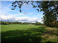
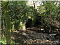
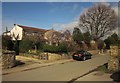
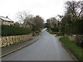


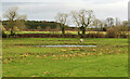
34 photos from this area
Area Information
Key information about the HG3 3BX including its size, population, and administrative classification.
- Area Type
- Postcode
- Area Size
- 68.6 hectares
- Population
- 1645
- Population Density
- 62 people/km²
House Prices in HG3 3BX
41
Properties
£637,398
Average Sold Price
£190,000
Lowest Price
£1,350,000
Highest Price
Showing 41 properties
| Address | Type | Beds | Baths | Last Sale Price | Last Sale Date | |
|---|---|---|---|---|---|---|
| The Shealing, Woolwich Cottage To Warren Lane, Brearton, HG3 3BX | house | - | - | £895,000 | Jun 2024 | |
| Fallows End, Woolwich Cottage To Warren Lane, Brearton, HG3 3BX | Detached | 5 | 2 | £965,000 | Nov 2022 | |
| Old Stones, Woolwich Cottage To Warren Lane, Brearton, HG3 3BX | Retail | 4 | 2 | £670,000 | Oct 2022 | |
| Stonecroft, Woolwich Cottage To Warren Lane, Brearton, HG3 3BX | Retail | 3 | 1 | £730,000 | Apr 2022 | |
| The Manor Barn, Woolwich Cottage To Warren Lane, Brearton, HG3 3BX | house | 5 | 2 | £1,200,000 | Dec 2021 | |
| Croft House, Woolwich Cottage To Warren Lane, Brearton, HG3 3BX | Semi-detached | 3 | 1 | £460,000 | Aug 2021 | |
| Rose Cottage, Woolwich Cottage To Warren Lane, Brearton, HG3 3BX | house | 4 | 2 | £350,000 | Nov 2020 | |
| Manor House Farm, Woolwich Cottage To Warren Lane, Brearton, HG3 3BX | Detached | 5 | 4 | £942,500 | Apr 2020 | |
| Barnfield House, Woolwich Cottage To Warren Lane, Brearton, HG3 3BX | Semi-detached | 4 | 2 | £800,000 | Aug 2018 | |
| Eastnor, Woolwich Cottage To Warren Lane, Brearton, HG3 3BX | house | - | - | £535,000 | Aug 2017 |
Page 1 of 5
Energy Efficiency in HG3 3BX
Amenities
Schools
| Rank | School | Type | Entry gender | Ages |
|---|
Explore more schools in this area
Go to Schools tabDemographics
Household Size
Two person
most common
Accommodation Type
Houses
most common
Tenure
83
majority
Ethnic Group
White
most common
Religion
N/A
most common
Household Composition
N/A
most common
Age
47
median
Adults (30-64 years)
most common
Household Deprivation
N/A
with no deprivation
NS-SEC
47
in Lower managerial occupations
Explore more demographic insights in this area
Go to Demographics tabPlanning
Planning Constraints
- Flood RiskPremium
- Ramsar Wetland SitesPremium
- Area of Outstanding Natural BeautyPremium
- Protected Nature ReservePremium
- Protected WoodlandPremium