Area Overview for HG3 3BN
Photos of HG3 3BN
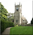
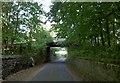

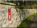
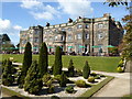
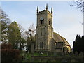
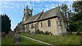
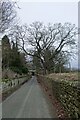
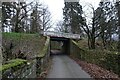
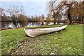
45 photos from this area
Area Information
Key information about the HG3 3BN including its size, population, and administrative classification.
- Area Type
- Postcode
- Area Size
- 1.3 km²
- Population
- 1314
- Population Density
- 90 people/km²
House Prices in HG3 3BN
22
Properties
£933,000
Average Sold Price
£328,000
Lowest Price
£1,560,000
Highest Price
Showing 22 properties
| Address | Type | Beds | Baths | Last Sale Price | Last Sale Date | |
|---|---|---|---|---|---|---|
| Vicarage House, Brearton Lane, Brearton, HG3 3BN | Detached | 8 | 3 | £1,560,000 | Feb 2022 | |
| Yarmer House, Town Street, Nidd, HG3 3BN | Detached | 5 | 2 | £1,200,000 | Feb 2021 | |
| Nidd Park House, Town Street, Nidd, HG3 3BN | house | 4 | - | £1,325,000 | Feb 2021 | |
| Lower Garden House, Town Street, Nidd, HG3 3BN | Bungalow | 4 | 3 | £710,000 | Jul 2016 | |
| Firs House, Town Street, Nidd, HG3 3BN | Detached | 4 | - | £475,000 | Aug 2007 | |
| The Coach House, Brearton Lane, Brearton, HG3 3BN | Detached | 4 | 2 | £328,000 | Apr 1998 | |
| Nidd Village Hall, Nidd To Flat Farm, Nidd, HG3 3BN | Detached | 10 | 7 | - | - | |
| Nidd Park Stables, Town Street, Nidd, HG3 3BN | Bungalow | 5 | 2 | - | - | |
| 2, Mulberry Cottage, Park Cottages, Town Street, Nidd, HG3 3BN | house | - | - | - | - | |
| Stables North Of Nidd Hall, Town Street To Lodge, Nidd, HG3 3BN | Equestrian | - | - | - | - |
Page 1 of 3
Energy Efficiency in HG3 3BN
Amenities
Schools
| Rank | School | Type | Entry gender | Ages |
|---|
Explore more schools in this area
Go to Schools tabDemographics
Household Size
Two person
most common
Accommodation Type
Houses
most common
Tenure
77
majority
Ethnic Group
White
most common
Religion
N/A
most common
Household Composition
N/A
most common
Age
47
median
Adults (30-64 years)
most common
Household Deprivation
N/A
with no deprivation
NS-SEC
44
in Lower managerial occupations
Explore more demographic insights in this area
Go to Demographics tabPlanning
Planning Constraints
- Flood RiskPremium
- Ramsar Wetland SitesPremium
- Area of Outstanding Natural BeautyPremium
- Protected Nature ReservePremium
- Protected WoodlandPremium