Area Overview for HG3 2BD
Photos of HG3 2BD
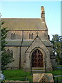
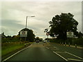
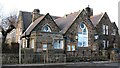
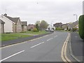
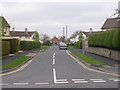
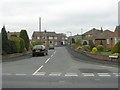
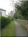
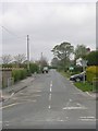
83 photos from this area
Area Information
Key information about the HG3 2BD including its size, population, and administrative classification.
- Area Type
- Postcode
- Area Size
- 19.4 hectares
- Population
- 2689
- Population Density
- 340 people/km²
House Prices in HG3 2BD
12
Properties
£334,429
Average Sold Price
£53,500
Lowest Price
£585,000
Highest Price
Showing 12 properties
| Address | Type | Beds | Baths | Last Sale Price | Last Sale Date | |
|---|---|---|---|---|---|---|
| 6 Crag Lane, Killinghall, HG3 2BD | Bungalow | 2 | 1 | £275,000 | Apr 2024 | |
| Quietways, Crag Lane, Killinghall, HG3 2BD | Detached | 5 | 3 | £540,000 | Jun 2019 | |
| 2 Crag Lane, Killinghall, HG3 2BD | house | - | - | £330,000 | Oct 2011 | |
| 4 Crag Lane, Killinghall, HG3 2BD | Semi-detached | - | - | £212,500 | Sep 2008 | |
| Craggdale, Crag Lane, Killinghall, HG3 2BD | Detached | - | - | £585,000 | Apr 2006 | |
| Crag Lodge, Crag Lane, Killinghall, HG3 2BD | Bungalow | - | - | £345,000 | Sep 2001 | |
| Delgany, 10 Crag Lane, Killinghall, HG3 2BD | Semi-detached | - | - | £53,500 | Jan 1995 | |
| Wensley House, 8 Crag Lane, Killinghall, HG3 2BD | house | 3 | - | - | - | |
| Springfield Farm, Crag Lane, Killinghall, HG3 2BD | Detached | - | - | - | - | |
| The Bungalow, Crag Lane, Killinghall, HG3 2BD | Bungalow | - | - | - | - |
Page 1 of 2
Energy Efficiency in HG3 2BD
Amenities
Schools
| Rank | School | Type | Entry gender | Ages |
|---|
Explore more schools in this area
Go to Schools tabDemographics
Household Size
Family (3-5 people)
most common
Accommodation Type
Houses
most common
Tenure
64
majority
Ethnic Group
White
most common
Religion
N/A
most common
Household Composition
N/A
most common
Age
22
median
Young Adults (15-29 years)
most common
Household Deprivation
N/A
with no deprivation
NS-SEC
23
in Lower managerial occupations
Explore more demographic insights in this area
Go to Demographics tabPlanning
Planning Constraints
- Flood RiskPremium
- Ramsar Wetland SitesPremium
- Area of Outstanding Natural BeautyPremium
- Protected Nature ReservePremium
- Protected WoodlandPremium