Area Overview for HG3 1SF
Photos of HG3 1SF

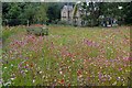
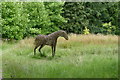
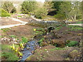
107 photos from this area
Area Information
Key information about the HG3 1SF including its size, population, and administrative classification.
- Area Type
- Postcode
- Area Size
- 1.1 km²
- Population
- 2689
- Population Density
- 340 people/km²
House Prices in HG3 1SF
8
Properties
£544,525
Average Sold Price
£305,000
Lowest Price
£775,000
Highest Price
Showing 8 properties
| Address | Type | Beds | Baths | Last Sale Price | Last Sale Date | |
|---|---|---|---|---|---|---|
| Ramstone, Pot Bridge Farm To Throstle Nest Farm, Beckwithshaw, HG3 1SF | house | - | - | £435,100 | Sep 2019 | |
| Meadowbank, Pot Bridge Farm To Throstle Nest Farm, Beckwithshaw, HG3 1SF | Bungalow | - | - | £305,000 | Nov 2016 | |
| Pott Bridge Farmhouse, Pot Bridge Farm To Throstle Nest Farm, Beckwithshaw, HG3 1SF | Detached | - | - | £663,000 | Jul 2016 | |
| Pot Bank Cottage, Pot Bank, Beckwithshaw, HG3 1SF | house | 4 | 1 | £775,000 | May 2014 | |
| Applewick, Pott Bridge Farm, Pot Bridge Farm To Throstle Nest Farm, Beckwithshaw, HG3 1SF | Detached | 5 | 3 | - | - | |
| Former Pott Bridge Farm, Pot Bridge Farm To Throstle Nest Farm, Beckwithshaw, HG3 1SF | Detached | - | - | - | - | |
| Caravan, Pott Bridge Farm, Pot Bridge Farm To Throstle Nest Farm, Beckwithshaw, HG3 1SF | Mobile Home | - | - | - | - | |
| Pott Bridge Farm, Pot Bridge Farm To Throstle Nest Farm, Beckwithshaw, HG3 1SF | Farm | - | - | - | - |
Energy Efficiency in HG3 1SF
Amenities
Schools
| Rank | School | Type | Entry gender | Ages |
|---|
Explore more schools in this area
Go to Schools tabDemographics
Household Size
Family (3-5 people)
most common
Accommodation Type
Houses
most common
Tenure
64
majority
Ethnic Group
White
most common
Religion
N/A
most common
Household Composition
N/A
most common
Age
22
median
Young Adults (15-29 years)
most common
Household Deprivation
N/A
with no deprivation
NS-SEC
23
in Lower managerial occupations
Explore more demographic insights in this area
Go to Demographics tabPlanning
Planning Constraints
- Flood RiskPremium
- Ramsar Wetland SitesPremium
- Area of Outstanding Natural BeautyPremium
- Protected Nature ReservePremium
- Protected WoodlandPremium