Area Overview for HG3 1QL
Photos of HG3 1QL
Area Information
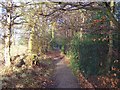
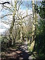
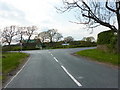
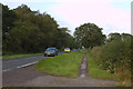
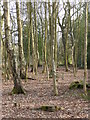
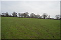
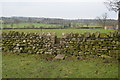
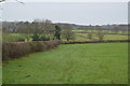
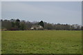
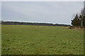
HG3 1QL is a compact residential cluster spanning just 1.1 km² in North Yorkshire. It is home to 1,708 residents, creating a low-density environment where homes sit at an average of 23 people per square kilometre. You are buying into a quiet community defined by its rural character and proximity to larger towns rather than urban hustle. This postcode represents a specific pocket of settlement where daily life revolves around local amenities and access to the wider region. The area offers a traditional living experience suitable for those seeking connectivity without the pressure of city living. You gain access to essential services while benefiting from the spacious feel that comes with such low population density. The landscape here is dominated by detached and semi-detached properties, typical of the surrounding countryside. Residents enjoy a sense of independence that is rare in more densely populated districts. The location provides a stable foundation for families and retirees who value tranquility. You will find that life in HG3 1QL is measured by proximity to schools, shops, and rail links rather than proximity to skyscrapers. This area serves as a strategic base for accessing Harrogate and other nearby services while maintaining a private atmosphere.
- Area Type
- Postcode
- Area Size
- 1.1 km²
- Population
- 1708
- Population Density
- 23 people/km²
The housing market in HG3 1QL is characterised by a dominance of owner-occupied homes. With 84% of properties in this postcode being owner-occupied, you will find that the area is not a hub for student accommodation or short-term rentals. The accommodation type is exclusively houses, meaning you should expect bungalows, detached homes, or semi-detached bungalows rather than flats or maisonettes. This specific mix caters to families and older residents who require private gardens and single-level living. Because the area covers only 1.1 km², the choice of homes is limited by physical boundaries. You are buying into a stock that has been cultivated over many years rather than one undergoing rapid new development. The prevalence of homeownership suggests a market where values are driven by property condition and location rather than speculative trends. Buyers here are often looking for established homes that require less immediate renovation than new builds. The lack of rental stock means competition for any available purchase is likely to come from other permanent residents. HG3 1QL remains a true homebuyer market where transactions reflect long-term planning. This consistency offers stability for investors looking for secure assets rather than high-yield rental returns.
House Prices in HG3 1QL
Showing 17 properties
| Address | Type | Beds | Baths | Last Sale Price | Last Sale Date | |
|---|---|---|---|---|---|---|
| Woodside Farm, Otley Road, Beckwithshaw, HG3 1QL | house | - | - | £585,000 | Oct 2004 | |
| Cardale House, Cardale Estate, Pot Bank, Beckwithshaw, HG3 1QL | Office | - | - | - | - | |
| Caravan 17, Cardale Estate, Pot Bank, Beckwithshaw, HG3 1QL | Terraced | 2 | - | - | - | |
| The Coach House, Sandringham House, Otley Road, Beckwithshaw, HG3 1QL | Detached | 3 | 2 | - | - | |
| The Apartment, Sandringham House, Otley Road, Beckwithshaw, HG3 1QL | Flat | 5 | 2 | - | - | |
| Caravan 20, Cardale Estate, Pot Bank, Beckwithshaw, HG3 1QL | Semi-detached | 2 | 1 | - | - | |
| Beechfield Farm, Otley Road To Beechfield Farm, Beckwithshaw, HG3 1QL | house | 6 | - | - | - | |
| Beechfield Cottage, Otley Road To Beechfield Farm, Beckwithshaw, HG3 1QL | Detached | - | - | - | - | |
| Windmill Farm, Otley Road To Windmill Farm, Beckwithshaw, HG3 1QL | Detached | - | - | - | - | |
| Caravan 4, Cardale Estate, Pot Bank, Beckwithshaw, HG3 1QL | Mobile Home | - | - | - | - |
Energy Efficiency in HG3 1QL
Daily life in HG3 1QL benefits from a practical range of amenities within easy reach. Retail options include Co-op Harlow Hill located just 50 metres away, Sainsburys in Cold, and Morrisons Daily. These three high street names provide access to groceries, household essentials, and daily necessities without requiring a long drive. You have five retail outlets to choose from for your shopping needs, ensuring that routine errands are conducted quickly and efficiently. Public transport relies on five nearby railway stations which serve as key nodes for regional travel. Harrogate Railway Station, Hornbeam Park Railway Station, and Pannal Railway Station are all accessible to residents of HG3 1QL. This rail connectivity links you to major cities and employment centres beyond the immediate postcodes. The presence of these stations means you can commute to work or visit relatives without dependence on cars for every journey. Shopping and transport combine to create a lifestyle that feels connected to the wider world despite the rural setting. You can walk to Co-op Harlow Hill for quick purchases or drive to the rail stations for longer trips. This balance of local convenience and regional access defines the convenience of living here.
Amenities
Schools
Families looking at homes in HG3 1QL will find a dedicated cluster of primary education options nearby. Beckwithshaw Community Primary School sits close to the area and holds a Good Ofsted rating, indicating strong educational standards. North Rigton Church of England Primary School serves the locality and is listed among the nearest educational institutions for your consideration. Norwood Primary School is another provision available to families within practical reach of HG3 1QL. The presence of multiple primary schools suggests a focus on early childhood education in the wider district. You will need to verify which school your property falls within for Catchment purposes, but these three options provide a solid foundation for children's learning. There are no secondary schools listed within the immediate HG3 1QL boundary, so you must factor in travel time to larger towns for older students. The concentration of primary schools in this direction supports families who value convenience and shorter commute times for their children. Each of these institutions offers a different curriculum and ethos, allowing you to choose the best fit for your child's needs. The availability of these schools directly supports the demographic of adults aged 30 to 64 living in the area.
| Rank | School | Type | Entry gender | Ages |
|---|
Explore more schools in this area
Go to Schools tabDemographics
The community in HG3 1QL is defined by a mature population profile. The median age sits at 47 years, with adults between 30 and 64 years old being the most common age range. This demographic shift means you are likely looking at an area populated by established families in later stages of life or retirement-age individuals. Homeownership is exceptionally high in this postcode, with 84% of residents owning their homes outright or with a mortgage. This figure indicates a deeply settled community where property turnover is typically slower than in rental-heavy districts. The predominant accommodation type consists of houses, reflecting the suburban and rural nature of the settlement. There is no significant presence of apartments or high-density flats within this boundary. The population is overwhelmingly White, contributing to a homogenous local culture. Living here means joining a neighbourhood where long-term residents are the norm rather than short-term tenants. This stability often translates into stronger local governance and well-maintained public spaces. You are not buying into a transient zone but into a place where people put down permanent roots. The high ownership rate suggests that buyers here value security and equity over the flexibility of renting.
Household Size
Accommodation Type
Tenure
Ethnic Group
Religion
Household Composition
Age
Household Deprivation
NS-SEC
Explore more demographic insights in this area
Go to Demographics tabPlanning
Planning Constraints
- Flood RiskPremium
- Ramsar Wetland SitesPremium
- Area of Outstanding Natural BeautyPremium
- Protected Nature ReservePremium
- Protected WoodlandPremium