Area Overview for HG2 9RD
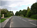
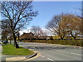
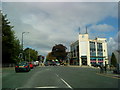
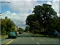
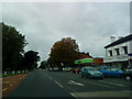
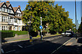
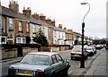
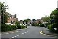
Photos of HG2 9RD


Area Information
HG2 9RD is a small, tightly packed residential cluster in England, home to 1,506 people spread across a densely populated area. With 1,355 people per square kilometre, it’s a compact community where daily life is shaped by proximity to essential services and transport links. The area’s character is defined by its mix of older and newer housing stock, predominantly owner-occupied homes. Residents benefit from strong digital connectivity and low crime rates, making it an appealing choice for those prioritising safety and convenience. The postcode lies near key retail hubs like M&S Oatlands and Sainsburys Harrogate, while rail stations such as Hornbeam Park and Harrogate offer easy access to regional centres. Despite its small size, HG2 9RD balances residential tranquillity with practical connectivity, catering to a population skewed towards adults aged 30–64. This demographic, combined with high home ownership, suggests a stable, long-term community. For buyers, the area’s compact nature means every amenity is within walking or short driving distance, though its limited size may restrict expansion.
- Area Type
- Postcode
- Area Size
- Not available
- Population
- 1506
- Population Density
- 1355 people/km²
HG2 9RD is predominantly an owner-occupied area, with 91% of homes owned by their residents rather than rented. This high rate of home ownership suggests a community of long-term residents who are less likely to move frequently, which can create a stable property market. The accommodation is almost exclusively houses, rather than flats or apartments, which is uncommon in more densely populated areas. This housing stock may appeal to buyers seeking larger, more traditional homes, though the limited size of the postcode means the available properties are relatively few. The small scale of the area could make it challenging for first-time buyers or those seeking a wider selection of properties. However, the high home ownership rate and low crime risk may make it an attractive option for those prioritising security and a settled lifestyle.
House Prices in HG2 9RD
No properties found in this postcode.
Energy Efficiency in HG2 9RD
Living in HG2 9RD offers access to a range of nearby amenities, including retail outlets such as M&S Oatlands, Co-op Leeds, and Sainsburys Harrogate. These shops provide everyday essentials, reducing the need for long trips to larger centres. The area’s rail stations—Hornbeam Park, Pannal, and Harrogate—connect residents to broader regional networks, enabling easy travel to cultural, professional, or leisure destinations. While the postcode itself is small, the proximity to these amenities ensures convenience for daily life. The retail options suggest a practical, family-friendly environment where residents can shop, dine, and access services without significant travel. The mix of retail and transport links supports a lifestyle that balances local convenience with regional connectivity.
Amenities
Schools
| Rank | School | Type | Entry gender | Ages |
|---|
Explore more schools in this area
Go to Schools tabDemographics
The population of HG2 9RD is predominantly adults aged 30–64, with a median age of 47. This suggests a mature, established community with fewer young families or retirees compared to other areas. Home ownership is exceptionally high at 91%, indicating a strong preference for long-term residency over renting. The area’s accommodation is almost entirely houses, rather than flats or apartments, which aligns with the demographic profile of older, settled residents. The predominant ethnic group is White, though no specific data on diversity or deprivation is provided. The high home ownership rate and age profile imply a stable, low-turnover environment where residents are likely to remain for extended periods. This stability may influence local services and amenities, which are tailored to the needs of middle-aged and older adults.
Household Size
Accommodation Type
Tenure
Ethnic Group
Religion
Household Composition
Age
Household Deprivation
NS-SEC
Explore more demographic insights in this area
Go to Demographics tabPlanning
Planning Constraints
- Flood RiskPremium
- Ramsar Wetland SitesPremium
- Area of Outstanding Natural BeautyPremium
- Protected Nature ReservePremium
- Protected WoodlandPremium