Area Overview for HG2 9HT
Photos of HG2 9HT
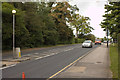
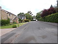
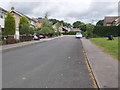
65 photos from this area
Area Information
Key information about the HG2 9HT including its size, population, and administrative classification.
- Area Type
- Postcode
- Area Size
- 9367 m²
- Population
- 1547
- Population Density
- 1862 people/km²
House Prices in HG2 9HT
12
Properties
£432,150
Average Sold Price
£95,000
Lowest Price
£715,000
Highest Price
Showing 12 properties
| Address | Type | Beds | Baths | Last Sale Price | Last Sale Date | |
|---|---|---|---|---|---|---|
| 15 Firs Crescent, Harrogate, HG2 9HT | Detached | 4 | 2 | £715,000 | Dec 2020 | |
| 6 Firs Crescent, Harrogate, HG2 9HT | Detached | 4 | - | £685,000 | Feb 2017 | |
| 10 Firs Crescent, Harrogate, HG2 9HT | Bungalow | - | - | £430,000 | Aug 2016 | |
| 5 Firs Crescent, Harrogate, HG2 9HT | house | - | - | £477,500 | Jun 2016 | |
| 7 Firs Crescent, Harrogate, HG2 9HT | house | - | - | £416,000 | Jul 2015 | |
| 1 Firs Crescent, Harrogate, HG2 9HT | Bungalow | 3 | 1 | £280,000 | Jun 2013 | |
| 11 Firs Crescent, Harrogate, HG2 9HT | house | 3 | - | £410,000 | Nov 2010 | |
| 9 Firs Crescent, Harrogate, HG2 9HT | house | 4 | - | £393,000 | Jul 2010 | |
| 4 Firs Crescent, Harrogate, HG2 9HT | Detached | - | - | £420,000 | Mar 2009 | |
| 8 Firs Crescent, Harrogate, HG2 9HT | Detached | - | - | £95,000 | Apr 1996 |
Page 1 of 2
Energy Efficiency in HG2 9HT
Amenities
Schools
| Rank | School | Type | Entry gender | Ages |
|---|
Explore more schools in this area
Go to Schools tabDemographics
Household Size
Two person
most common
Accommodation Type
Houses
most common
Tenure
85
majority
Ethnic Group
White
most common
Religion
N/A
most common
Household Composition
N/A
most common
Age
47
median
Adults (30-64 years)
most common
Household Deprivation
N/A
with no deprivation
NS-SEC
52
in Lower managerial occupations
Explore more demographic insights in this area
Go to Demographics tabPlanning
Planning Constraints
- Flood RiskPremium
- Ramsar Wetland SitesPremium
- Area of Outstanding Natural BeautyPremium
- Protected Nature ReservePremium
- Protected WoodlandPremium