Area Overview for HG2 9BD
Photos of HG2 9BD

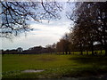
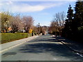
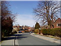
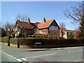
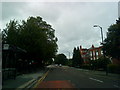
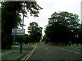
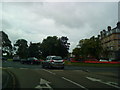
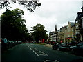

100 photos from this area
Area Information
Key information about the HG2 9BD including its size, population, and administrative classification.
- Area Type
- Postcode
- Area Size
- 1.7 hectares
- Population
- 1490
- Population Density
- 3887 people/km²
House Prices in HG2 9BD
37
Properties
£465,704
Average Sold Price
£99,950
Lowest Price
£807,500
Highest Price
Showing 37 properties
| Address | Type | Beds | Baths | Last Sale Price | Last Sale Date | |
|---|---|---|---|---|---|---|
| 14 Westbourne Avenue, Harrogate, HG2 9BD | Detached | 3 | 2 | £807,500 | Apr 2025 | |
| 27 Westbourne Avenue, Harrogate, HG2 9BD | Semi-detached | 4 | 1 | £700,000 | Feb 2025 | |
| 33 Westbourne Avenue, Harrogate, HG2 9BD | Semi-detached | 3 | 1 | £750,000 | Nov 2024 | |
| 6 Westbourne Avenue, Harrogate, HG2 9BD | Semi-detached | 3 | 1 | £720,000 | Dec 2023 | |
| 21 Westbourne Avenue, Harrogate, HG2 9BD | Semi-detached | 4 | 2 | £580,000 | Sep 2021 | |
| 9 Westbourne Avenue, Harrogate, HG2 9BD | house | - | - | £533,500 | Apr 2021 | |
| 26 Westbourne Avenue, Harrogate, HG2 9BD | house | - | - | £670,000 | Mar 2021 | |
| 12 Westbourne Avenue, Harrogate, HG2 9BD | Semi-detached | 4 | 1 | £607,000 | Oct 2019 | |
| 25 Westbourne Avenue, Harrogate, HG2 9BD | house | 4 | - | £595,000 | Sep 2015 | |
| 1 Westbourne Avenue, Harrogate, HG2 9BD | house | 4 | 3 | £625,500 | Aug 2015 |
Page 1 of 4
Energy Efficiency in HG2 9BD
Amenities
Schools
| Rank | School | Type | Entry gender | Ages |
|---|
Explore more schools in this area
Go to Schools tabDemographics
Household Size
One person
most common
Accommodation Type
Flats
most common
Tenure
67
majority
Ethnic Group
White
most common
Religion
N/A
most common
Household Composition
N/A
most common
Age
47
median
Adults (30-64 years)
most common
Household Deprivation
N/A
with no deprivation
NS-SEC
54
in Lower managerial occupations
Explore more demographic insights in this area
Go to Demographics tabPlanning
Planning Constraints
- Flood RiskPremium
- Ramsar Wetland SitesPremium
- Area of Outstanding Natural BeautyPremium
- Protected Nature ReservePremium
- Protected WoodlandPremium