Area Overview for HG2 9AT
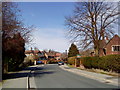
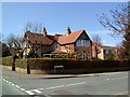
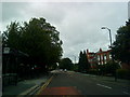
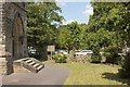
Photos of HG2 9AT


Area Information
HG2 9AT is a small residential postcode area in England with a population of 1,490, reflecting a tight-knit community. The area’s compact size means it is likely a cluster of properties serving local needs, with no sprawling suburbs or commercial zones. Residents here are predominantly adults aged 30–64, suggesting a mature demographic with established careers and families. The low crime risk score of 94/100 indicates a safe environment, while the absence of flood risk or protected natural areas means residents face minimal environmental hazards. Nearby, independent schools like West End School and Harrogate Tutorial College cater to families, and digital connectivity is strong, with a broadband score of 100. Rail access is practical, with multiple stations within reach. This area offers a blend of security, convenience, and proximity to essential services, making it appealing for those seeking a stable, low-maintenance lifestyle.
- Area Type
- Postcode
- Area Size
- Not available
- Population
- 1490
- Population Density
- 3887 people/km²
The property market in HG2 9AT is characterised by a 67% home ownership rate, suggesting a mix of owner-occupied and rental properties. The accommodation type is predominantly flats, which implies a more compact housing stock, likely within multi-unit buildings or developments. Given the area’s small size, the available housing is limited, and buyers may need to consider nearby postcode areas for more options. The presence of flats could indicate a focus on affordability or convenience, though the lack of data on property prices or market trends means specific investment potential remains unclear. For those seeking a home, the area’s safety and proximity to amenities may outweigh its limited housing supply.
House Prices in HG2 9AT
No properties found in this postcode.
Energy Efficiency in HG2 9AT
The lifestyle in HG2 9AT is defined by proximity to essential amenities. Retail options include Cook Harrogate, Co-op Harlow Hill, and Sainsburys Harrogate, ensuring access to groceries and daily necessities. The rail network, with stations like Hornbeam Park and Harrogate, offers easy travel to surrounding areas. While the data does not mention parks or leisure facilities, the absence of protected natural areas suggests no restrictions on local development or recreational use. The area’s character is one of practicality, with amenities focused on functionality rather than luxury. Residents benefit from a straightforward, no-frills approach to living, where convenience and accessibility are prioritised over expansive leisure options.
Amenities
Schools
Residents of HG2 9AT have access to two independent schools: West End School and Harrogate Tutorial College. Both institutions are private, offering education outside the state system. Independent schools often provide smaller class sizes, specialist facilities, and alternative curricula, which may appeal to families prioritising tailored education. However, the absence of state schools in the data means the area’s options are limited to private institutions. This could be a consideration for buyers seeking affordability or flexibility in schooling, though the quality of these schools is not rated here. The presence of two independent schools suggests a local demand for private education, potentially reflecting the area’s demographic of established professionals.
| Rank | School | Type | Entry gender | Ages |
|---|
Explore more schools in this area
Go to Schools tabDemographics
The population of HG2 9AT is 1,490, with a median age of 47, indicating a community dominated by middle-aged adults. The most common age range is 30–64 years, suggesting a mix of professionals and families. Home ownership stands at 67%, meaning nearly two-thirds of residents live in properties they own, while the remaining 33% may be renters or in other arrangements. The accommodation type is primarily flats, reflecting a housing stock suited to urban or semi-urban living. The predominant ethnic group is White, and no data on diversity or deprivation is provided. This demographic profile points to a stable, possibly family-oriented community with a focus on long-term residency rather than transient populations.
Household Size
Accommodation Type
Tenure
Ethnic Group
Religion
Household Composition
Age
Household Deprivation
NS-SEC
Explore more demographic insights in this area
Go to Demographics tabPlanning
Planning Constraints
- Flood RiskPremium
- Ramsar Wetland SitesPremium
- Area of Outstanding Natural BeautyPremium
- Protected Nature ReservePremium
- Protected WoodlandPremium