Area Overview for HG2 8JW
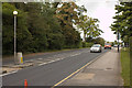
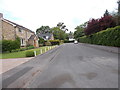
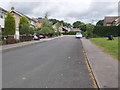
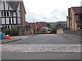
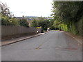
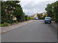
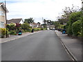
Photos of HG2 8JW

Area Information
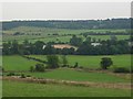
HG2 8JW is a small, tightly knit residential area in England, home to 1,568 people spread across a compact cluster of homes. With a population density of 511 people per square kilometre, it balances community closeness with manageable size. This area is defined by its quiet, family-oriented character, with a median age of 47 and a majority of residents aged 30–64. The presence of five nearby retail outlets, including M&S Oatlands and Co-op Leeds, suggests a practical approach to daily life, while proximity to railway stations like Hornbeam Park and Harrogate ensures easy access to larger towns. The low crime risk score of 91 and absence of environmental constraints like flood zones or protected woodlands make it appealing for those prioritising safety and stability. Living here means a slower pace of life, with homes predominantly owner-occupied and a strong sense of local identity. The area’s compact nature means amenities are within practical reach, making it ideal for those seeking a balance between convenience and tranquillity.
- Area Type
- Postcode
- Area Size
- Not available
- Population
- 1568
- Population Density
- 511 people/km²
The property market in HG2 8JW is dominated by owner-occupied homes, with 84% of properties owned by residents rather than rented. This high ownership rate indicates a community of long-term residents and a market that prioritises stability over short-term investment. The accommodation type is predominantly houses, which is unusual for areas with smaller populations, suggesting a focus on family homes or larger properties. Given the area’s compact size, the housing stock is likely limited, making it a niche market for buyers seeking a specific type of property. The lack of rental properties means demand for homes is driven by those looking to settle permanently, rather than speculative buyers. For those considering the area, the scarcity of properties may mean a slower, more deliberate buying process, but the owner-occupied nature could indicate strong community ties and long-term value retention.
House Prices in HG2 8JW
No properties found in this postcode.
Energy Efficiency in HG2 8JW
Residents of HG2 8JW have access to a range of nearby amenities, including five retail outlets such as M&S Oatlands, Co-op Leeds, and M&S Pannal BP, which provide essential shopping and services. The proximity to railway stations like Hornbeam Park and Harrogate ensures easy access to public transport, supporting both local and regional travel. While the area itself is small, the surrounding region likely offers additional leisure and recreational opportunities. The presence of retail and transport hubs within practical reach suggests a lifestyle that balances convenience with the tranquillity of a smaller community. For daily life, the area’s amenities are sufficient for basic needs, though residents may need to travel further for more specialised services or entertainment.
Amenities
Schools
| Rank | School | Type | Entry gender | Ages |
|---|
Explore more schools in this area
Go to Schools tabDemographics
The community in HG2 8JW is predominantly composed of adults aged 30–64, with a median age of 47. This suggests a mature, established population, likely with long-term ties to the area. Home ownership is high, at 84%, indicating a stable, long-term resident base rather than a transient rental market. The accommodation type is primarily houses, which aligns with the area’s residential character and may appeal to families or those seeking more space. The predominant ethnic group is White, though no specific data on diversity or deprivation is provided. The age profile and ownership figures suggest a community focused on stability, with fewer young families or students. This demographic mix likely supports a low-maintenance lifestyle, with services and amenities tailored to the needs of middle-aged and older residents.
Household Size
Accommodation Type
Tenure
Ethnic Group
Religion
Household Composition
Age
Household Deprivation
NS-SEC
Explore more demographic insights in this area
Go to Demographics tabPlanning
Planning Constraints
- Flood RiskPremium
- Ramsar Wetland SitesPremium
- Area of Outstanding Natural BeautyPremium
- Protected Nature ReservePremium
- Protected WoodlandPremium