Area Overview for HG2 8HL
Photos of HG2 8HL
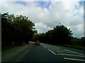
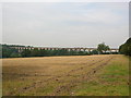
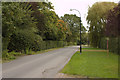
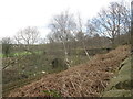
93 photos from this area
Area Information
Key information about the HG2 8HL including its size, population, and administrative classification.
- Area Type
- Postcode
- Area Size
- 6.1 hectares
- Population
- 1568
- Population Density
- 511 people/km²
House Prices in HG2 8HL
28
Properties
£579,591
Average Sold Price
£132,000
Lowest Price
£1,250,000
Highest Price
Showing 28 properties
| Address | Type | Beds | Baths | Last Sale Price | Last Sale Date | |
|---|---|---|---|---|---|---|
| The Hawthorns, 3C Fulwith Road, Harrogate, HG2 8HL | house | - | - | £1,155,000 | Mar 2018 | |
| 19 Fulwith Road, Harrogate, HG2 8HL | Bungalow | 5 | 4 | £640,000 | Jul 2016 | |
| Fulwith House, 5 Fulwith Road, Harrogate, HG2 8HL | Retail | 4 | 2 | £1,250,000 | Oct 2015 | |
| 14 Fulwith Road, Harrogate, HG2 8HL | Detached | 4 | - | £495,000 | Sep 2012 | |
| 15 Fulwith Road, Harrogate, HG2 8HL | house | 4 | - | £723,500 | Oct 2011 | |
| 1A Fulwith Road, Harrogate, HG2 8HL | Detached | 4 | 2 | £465,000 | Jun 2006 | |
| Tudor House, Fulwith Road, Harrogate, HG2 8HL | house | - | - | £730,000 | Dec 2003 | |
| 27 Fulwith Road, Harrogate, HG2 8HL | Detached | - | - | £230,000 | Jun 2000 | |
| 10 Fulwith Road, Harrogate, HG2 8HL | Detached | - | - | £340,000 | Nov 1999 | |
| 17 Fulwith Road, Harrogate, HG2 8HL | Detached | 4 | 3 | £132,000 | Jul 1999 |
Page 1 of 3
Energy Efficiency in HG2 8HL
Amenities
Schools
| Rank | School | Type | Entry gender | Ages |
|---|
Explore more schools in this area
Go to Schools tabDemographics
Household Size
Two person
most common
Accommodation Type
Houses
most common
Tenure
84
majority
Ethnic Group
White
most common
Religion
N/A
most common
Household Composition
N/A
most common
Age
47
median
Adults (30-64 years)
most common
Household Deprivation
N/A
with no deprivation
NS-SEC
54
in Lower managerial occupations
Explore more demographic insights in this area
Go to Demographics tabPlanning
Planning Constraints
- Flood RiskPremium
- Ramsar Wetland SitesPremium
- Area of Outstanding Natural BeautyPremium
- Protected Nature ReservePremium
- Protected WoodlandPremium