Area Overview for HG2 7SY
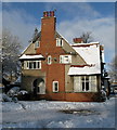
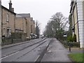
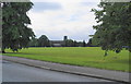
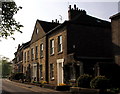
Photos of HG2 7SY


Area Information
HG2 7SY is a small, tightly knit residential postcode in England, home to just 1463 residents. It is a modest area characterised by a mix of houses and a mature population, with a median age of 47. The community is predominantly composed of adults aged 30–64, suggesting a stable, established demographic. Living here means access to nearby schools, retail, and rail links, though the area’s compact size means it is best suited for those prioritising convenience over sprawling amenities. The postcode’s small footprint reflects its residential focus, with no major industrial or commercial hubs nearby. For buyers, HG2 7SY offers a quiet, low-density living environment with a focus on proximity to essential services. Its proximity to Harrogate and surrounding railway stations makes it accessible for commuters, while the area’s safety profile and limited environmental constraints add to its appeal. This is a place where daily life revolves around local schools, shops, and community connections, ideal for those seeking a balanced, manageable lifestyle.
- Area Type
- Postcode
- Area Size
- Not available
- Population
- 1463
- Population Density
- 5036 people/km²
HG2 7SY’s property market is defined by a 45% home ownership rate, which is below the national average, indicating a higher proportion of rental properties. The accommodation type is predominantly houses, which is unusual for a small postcode but suggests a focus on single-family homes. This mix of ownership and rental properties may reflect the area’s appeal to both long-term residents and those seeking temporary housing. The limited size of the postcode means the housing stock is constrained, which could lead to competition among buyers. For those considering purchase, the presence of houses rather than apartments or high-rises may be a key consideration. The market is likely to cater to families or individuals prioritising private, low-density living. However, the small area’s proximity to Harrogate and rail links may also make it attractive to commuters or those seeking a balance between residential tranquillity and urban accessibility.
House Prices in HG2 7SY
Showing 1 properties
| Address | Type | Beds | Baths | Last Sale Price | Last Sale Date | |
|---|---|---|---|---|---|---|
| Occupational Health Unit, Heatherdene, Lancaster Park Road, Harrogate, HG2 7SY | hospital_care_home | - | - | - | - |
Energy Efficiency in HG2 7SY
The lifestyle in HG2 7SY is shaped by its proximity to retail and rail amenities. Within practical reach, residents can access five retail venues, including Co-op Wayside, Co-op Harrogate, and Lidl Harrogate, providing everyday shopping convenience. The rail network, with stations such as Starbeck and Harrogate, facilitates easy travel to nearby towns and cities, supporting both daily commutes and weekend excursions. While the data does not mention parks or leisure facilities, the area’s small size and focus on residential living suggest a community-oriented environment. The presence of multiple retail outlets and rail links indicates a practical, accessible lifestyle, though residents may need to travel further for more specialised amenities. The combination of local shops and transport options makes HG2 7SY a functional choice for those prioritising convenience over extensive leisure opportunities.
Amenities
Schools
Residents of HG2 7SY have access to three primary schools within practical reach. These include Woodlands Community Junior School in Harrogate and Willow Tree Community Primary School, which holds an Ofsted rating of 'good'. The presence of two primary schools suggests a focus on early education, though no secondary schools are listed in the data. For families, the availability of a 'good' rated primary school at Willow Tree Community Primary School is a notable advantage, offering a benchmark of quality for local education. The duplication of Willow Tree’s name in the data may indicate a local emphasis on primary schooling, though no further details on capacity or catchment areas are provided. The absence of secondary schools nearby means parents may need to consider commuting for older children, but the proximity to Harrogate could mitigate this. Overall, the area supports primary education with a mix of options, though secondary schooling is not within immediate reach.
| Rank | School | Type | Entry gender | Ages |
|---|
Explore more schools in this area
Go to Schools tabDemographics
The population of HG2 7SY is 1463, with a median age of 47, indicating a mature, stable community. The majority of residents fall within the 30–64 age range, reflecting a demographic skewed towards middle-aged adults. Home ownership stands at 45%, suggesting a mix of owner-occupied and rental properties, though the exact balance of rental versus purchase is not specified. The accommodation type is primarily houses, which is notable for a postcode of this size, implying a low-rise, family-oriented housing stock. The predominant ethnic group is White, though no further breakdown of diversity is provided. The absence of specific data on deprivation or income levels means the quality of life cannot be fully contextualised, but the low crime risk and lack of environmental constraints suggest a generally stable environment. This area is likely to attract buyers seeking a quiet, established neighbourhood with a focus on local amenities rather than urban vibrancy.
Household Size
Accommodation Type
Tenure
Ethnic Group
Religion
Household Composition
Age
Household Deprivation
NS-SEC
Explore more demographic insights in this area
Go to Demographics tabPlanning
Planning Constraints
- Flood RiskPremium
- Ramsar Wetland SitesPremium
- Area of Outstanding Natural BeautyPremium
- Protected Nature ReservePremium
- Protected WoodlandPremium