Area Overview for HG2 0NF
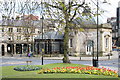
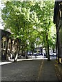
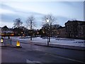
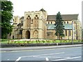
Photos of HG2 0NF


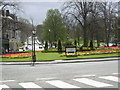
Area Information
HG2 0NF is a small, densely populated residential cluster in England, covering just 3,368 square metres and home to 1,759 residents. Its compact size means the area is tightly knit, with a high population density of 522,307 people per square kilometre. This postcode is characterised by a mature community, with a median age of 47 and the majority of residents aged between 30 and 64. Daily life here is shaped by proximity to essential services and transport links. The area’s small footprint ensures a quiet, residential atmosphere, though the high density may feel more urban than rural. Nearby, residents can access primary schools, retail outlets, and rail stations, making it practical for families and commuters. The presence of multiple schools, including St Peter’s Church of England Primary School and Harrogate Language Academy, adds to the area’s appeal for households with children. While the community is predominantly White and home ownership is low (23%), the area’s compact nature means amenities are within easy reach, balancing convenience with a sense of locality.
- Area Type
- Postcode
- Area Size
- 3368 m²
- Population
- 1759
- Population Density
- 5053 people/km²
The property market in HG2 0NF is dominated by rental flats, with home ownership at just 23%. This suggests the area functions more as a rental market than a place for long-term property investment. The predominance of flats, combined with the high population density, indicates a focus on compact, efficient housing suited to urban living. Buyers considering this area should note the limited availability of owner-occupied properties, which may make the market competitive for those seeking to purchase. The small size of the area means housing stock is concentrated, and the immediate surroundings likely offer similar options. For those prioritising proximity to amenities, the compact nature of HG2 0NF could be an advantage, though the rental focus may limit opportunities for equity growth. Potential buyers should assess whether the rental market’s dynamics align with their financial goals.
House Prices in HG2 0NF
No properties found in this postcode.
Energy Efficiency in HG2 0NF
The lifestyle in HG2 0NF is shaped by its proximity to retail and transport hubs. Within practical reach, residents can access five retail outlets, including Morrisons Daily, Tesco Cambridge, and Sainsburys Harrogate, ensuring everyday shopping needs are met. The rail network, with five stations nearby, connects the area to broader regional services, enhancing accessibility for both leisure and work. While the data does not mention parks or leisure facilities, the compact nature of the area means amenities are likely concentrated within a short walk or drive. The presence of multiple retail options and rail links suggests a practical, convenience-focused lifestyle, ideal for those prioritising ease of access over expansive green spaces. The small size of the area may foster a tight-knit community, though the density could also mean limited private outdoor areas for residents.
Amenities
Schools
Residents of HG2 0NF have access to three schools within practical reach. St Peter’s Church of England Primary School and Harrogate, St Peter’s Church of England Primary School are both primary institutions, providing education for younger children. Harrogate Language Academy, categorised as an 'other' school, may cater to specialist or secondary education needs. The presence of two primary schools offers families multiple options for early education, though the absence of secondary schools in the data means further schooling may require commuting. The mix of school types suggests a range of educational provisions, but the lack of specific Ofsted ratings or performance metrics means parents must rely on local recommendations. For families prioritising proximity to schools, the availability of primary education within the area is a key consideration, though secondary schooling may lie beyond the immediate vicinity.
| Rank | School | Type | Entry gender | Ages |
|---|
Explore more schools in this area
Go to Schools tabDemographics
The population of HG2 0NF is predominantly adults aged 30 to 64, reflecting a mature demographic with a median age of 47. Home ownership is limited, with only 23% of residents owning their homes, suggesting the area is more rental-focused than owner-occupied. The accommodation type is predominantly flats, which aligns with the high population density. The predominant ethnic group is White, though specific data on diversity or deprivation is not provided. This demographic profile indicates a community of middle-aged individuals, possibly professionals or families, who may prioritise proximity to services over long-term property investment. The high population density, while offering a sense of community, could also mean limited private outdoor space. The age range suggests a stable, established population, though the lack of data on younger or older residents means the full generational mix remains unclear.
Household Size
Accommodation Type
Tenure
Ethnic Group
Religion
Household Composition
Age
Household Deprivation
NS-SEC
Explore more demographic insights in this area
Go to Demographics tabPlanning
Planning Constraints
- Flood RiskPremium
- Ramsar Wetland SitesPremium
- Area of Outstanding Natural BeautyPremium
- Protected Nature ReservePremium
- Protected WoodlandPremium