Area Overview for HG1 4LE
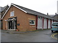
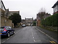
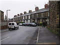
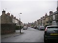
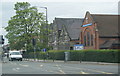
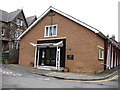
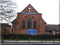
Photos of HG1 4LE


Area Information
HG1 4LE is a small, tightly packed residential area in England, covering just 3,181 square metres and home to 1,196 residents. With a population density of 375,964 people per square kilometre, this postcode is densely populated yet retains a quiet, community-focused character. Daily life here is shaped by its compact size and proximity to essential services. The area’s mix of housing and limited open space suggests a focus on convenience over sprawling development. Residents benefit from strong digital connectivity, with broadband rated excellent and mobile coverage good, supporting both work and leisure. While the area lacks major natural or protected sites, its safety profile is reassuring, with low flood risk and below-average crime rates. HG1 4LE is ideal for those seeking a compact, well-connected neighbourhood with access to local amenities and schools, though its small size means it’s best suited for those prioritising proximity to services over expansive living spaces.
- Area Type
- Postcode
- Area Size
- 3181 m²
- Population
- 1196
- Population Density
- 7942 people/km²
HG1 4LE is a predominantly owner-occupied area, with 53% of properties owned by residents rather than rented. The accommodation type is exclusively houses, which is unusual for a small postcode but suggests a focus on family homes or semi-detached properties. This housing stock may appeal to buyers seeking traditional, spacious living rather than modern apartments. The compact size of the area means property availability is limited, and the immediate surroundings may offer similar housing styles. For buyers, this could mean a competitive market with limited options, but the high home ownership rate indicates a stable demand. The absence of rental properties suggests a community where long-term residency is the norm, potentially reducing turnover and ensuring a consistent local character. Buyers should consider the area’s small footprint and the need for proximity to services when evaluating property value and suitability.
House Prices in HG1 4LE
No properties found in this postcode.
Energy Efficiency in HG1 4LE
HG1 4LE offers a range of nearby amenities, including five retail outlets such as Sainsburys Kings, Morrisons Daily Harrogate, and Co-op Harrogate. These stores provide everyday shopping needs, from groceries to household items, within practical reach. The area’s rail connectivity adds to its convenience, with stations like Harrogate Railway Station offering access to broader regional networks. While there is no mention of parks or leisure facilities in the data, the presence of multiple retail and transport options suggests a lifestyle focused on accessibility and practicality. The compact nature of the area means residents can easily access services without long commutes, fostering a self-contained community. However, the lack of specific details on leisure or recreational spaces leaves some aspects of daily life unexplored, though the existing amenities contribute to a functional, everyday convenience.
Amenities
Schools
Residents of HG1 4LE have access to Harrogate, Grove Road Community Primary School, which is rated 'good' by Ofsted. This primary school serves the local community, offering education for younger children. However, the area also includes Harrogate Pupil Referral Service and Springwell Harrogate, both categorised as 'other' schools, which may cater to specialist needs or alternative education. The absence of secondary schools within the postcode means families may need to look further afield for comprehensive education. While the primary school is a positive asset, the limited range of school types could be a consideration for parents seeking a full spectrum of educational options. The 'good' rating at the primary level is a strong point, but the overall school mix suggests a need for additional research into secondary schooling and extracurricular opportunities in nearby areas.
| Rank | School | Type | Entry gender | Ages |
|---|
Explore more schools in this area
Go to Schools tabDemographics
The community in HG1 4LE is predominantly middle-aged, with a median age of 47 and the majority of residents falling within the 30-64 age range. Home ownership is strong, with 53% of properties occupied by their owners, indicating a stable, long-term resident base. The area is characterised by houses rather than flats, reflecting a traditional residential layout. The predominant ethnic group is White, though no specific data on diversity or deprivation is provided. The high proportion of adult residents suggests a mature community, likely with established families and professionals. With no data on income levels or deprivation, it’s unclear how this affects quality of life, but the low crime rate and safety score of 79/100 imply a secure environment. The age profile and home ownership figures suggest a neighbourhood where residents are likely to have long-term ties, contributing to a cohesive local identity.
Household Size
Accommodation Type
Tenure
Ethnic Group
Religion
Household Composition
Age
Household Deprivation
NS-SEC
Explore more demographic insights in this area
Go to Demographics tabPlanning
Planning Constraints
- Flood RiskPremium
- Ramsar Wetland SitesPremium
- Area of Outstanding Natural BeautyPremium
- Protected Nature ReservePremium
- Protected WoodlandPremium